Saturday, October 01, 2005
America the Beautiful
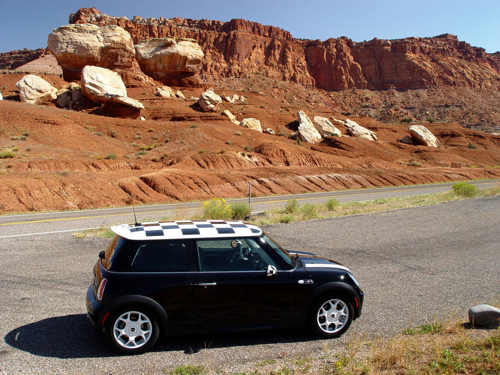
We leave Bryce Canyon going southeast on Highway 12. The road leads down through the arid canyon lands we saw from Bryce.
We go through Tropic, Cannonville and Henrieville, old towns filled with small houses in large, flat valleys. I have noticed that most old houses in the Southwest are small. The long irrigation lines with their large wheels are spraying brilliantly in the morning light, making the fields green.
The road turns northeast, gathering more vegetation and trees as we approach Escalante. Cows a
 nd horses graze here and there in fields and in the dry wash beds. At Escalante, a half-dozen turkeys cross the road!
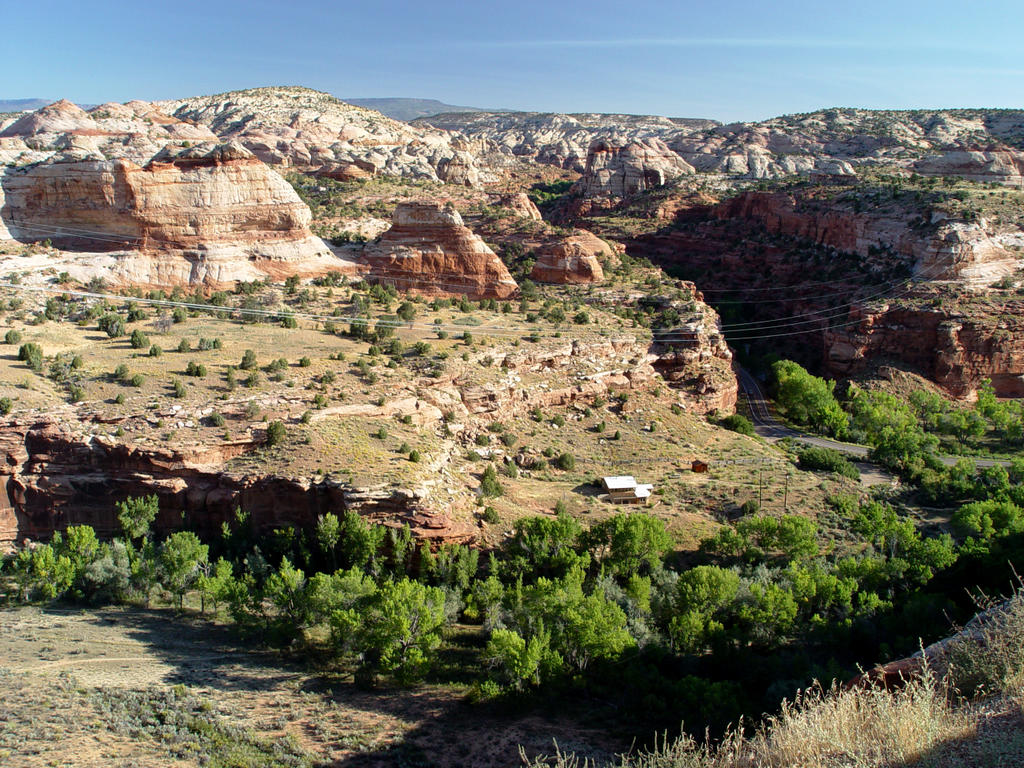
Going east, the country turns to canyon lands again after Escalante, colors alternating between white rock canyons and red. We come to a large area of white rounded canyons of deeply scored smooth, bare rock. It’s different from the other areas and quite striking. The variety of rock shapes and colors and quantity or lack of vegetation in this Southwest trip are astonishing. Within a few minutes the landscape can change completely. Or…..it can just go on forever!
 The red Escalante Canyons and Calf Creek area are especially beautiful, a narrow river valley filled with trees and grass with the canyon walls close to the road. There is camping nearby and nature trails which I’m sure would be great to see.
We turn north to Boulder (Utah!), a town sitting on the edge of white-plateaued cliffs. The large, flat valley next to them is filled with grass, trees and little old houses. Neat motels and camp outfitters dot the valley and nearby hills. I get the feeling it’s an organic community. (Probably full of Bush haters!) I really liked the looks of this town.
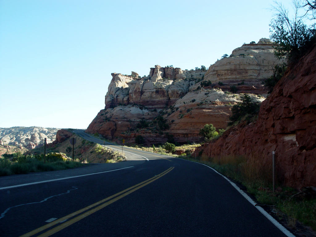
 After Boulder, the mountains turn to wooded pine. A deer and fawn graze in a small meadow. The road ascends north into green rocky pastures with birch and other trees, creating beautiful, pastoral scenes with vistas of canyons below.
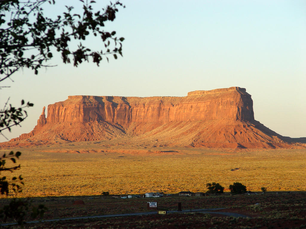
We descend from the Boulder Mountains just south of Grover. Mark is having fun again, racing thru some curves. As we come over a little hill, three giant black cows are standing right next to the road! Boy, that would have been a mess! Grover sits below, in flat, green valleys with red cliffs all around. North of Grover, the vast red plateau cliffs of Capitol Reef run west to east. I
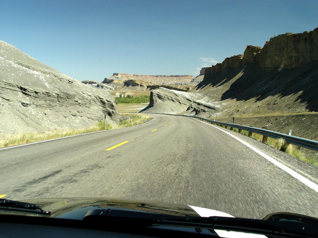
 didn’t understand why it is called a Reef, but looked at from a distance, it looks like you are coming up to a reef or an island, the plateau is so large. The road, Highway 24 now, follows it along on the south side, a spectacular ride.
After a while, the red cliffs turn tan with the road going through them. Then the cliffs turn into a bizarre, gravely gray landscape with no plants, very similar to the Tepee area of the Petrified Forest. This area is called Luna Mesa. I think it is between Caineville and Hanksville. I wish we had stopped at a weird store we raced by, called the Luna Mesa Oasis. It’s a little hippie shack covered
 with kitschy stuff sitting next to the road. I don’t even know if it’s really operating any more, but it looked intriguing!
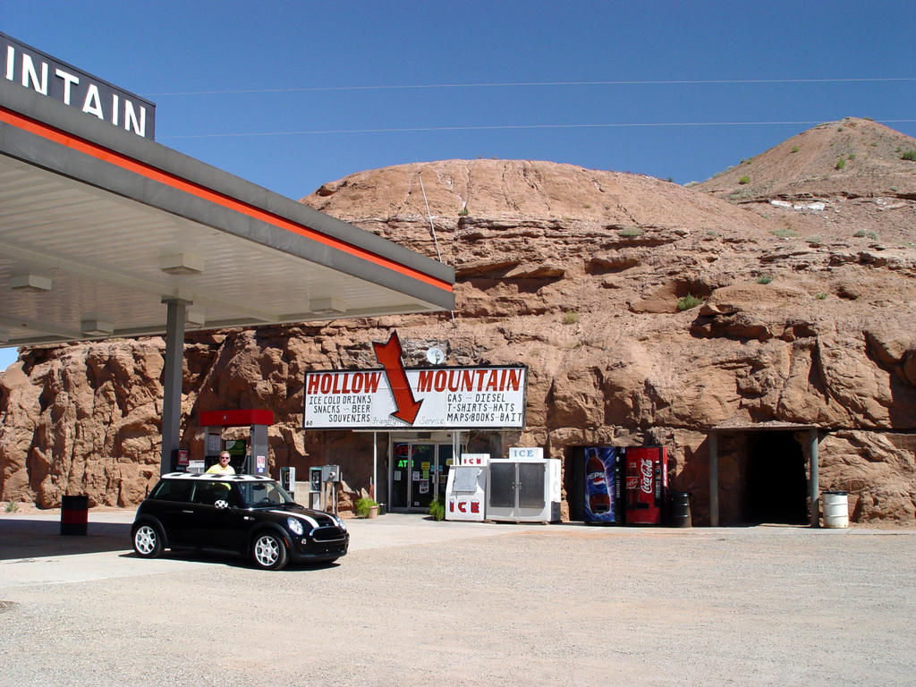
We stopped in Hanksville to get gas at Hollow Mountain, a store built inside a little mountain! Then we went next door to Blondie’s (surprisingly good), the only restaurant for the next 100 miles until Monument Valley. So be forewarned! There are no towns going south from Hanksville on Highway 95.
We drive south, through desert lands on the east and the tall, dark, Henry Mountains on the west.
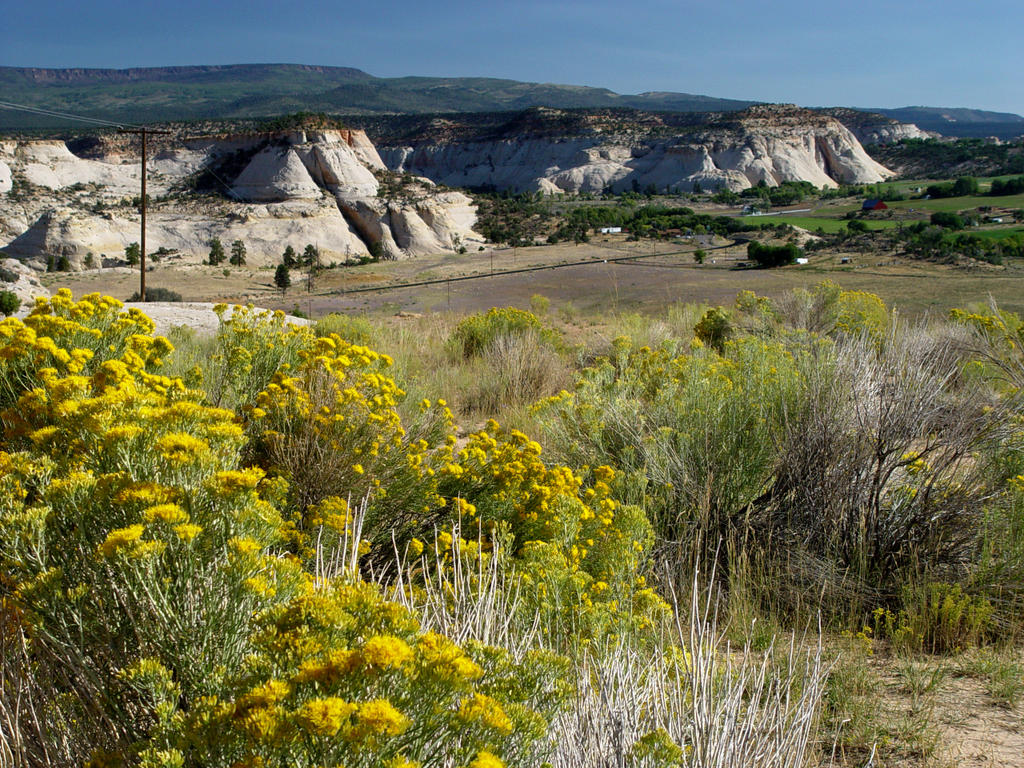
 There are no trees. The ground cover is dark green, light green, blond, tan and yellow. We are amazed in this trip at how colorful the desert can be.
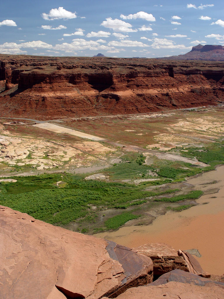
Near N. Junction 276 we pass through light red-tan rounded top cliffs very close to the road. Little green trees and scrub cover the valley floor. The cliffs turn redder going down to Glen Canyon. Lake Powell is all dried up! It’s pathetic! The boat ramp, which looks like an airport runway, still isn’t long enough to reach the water!
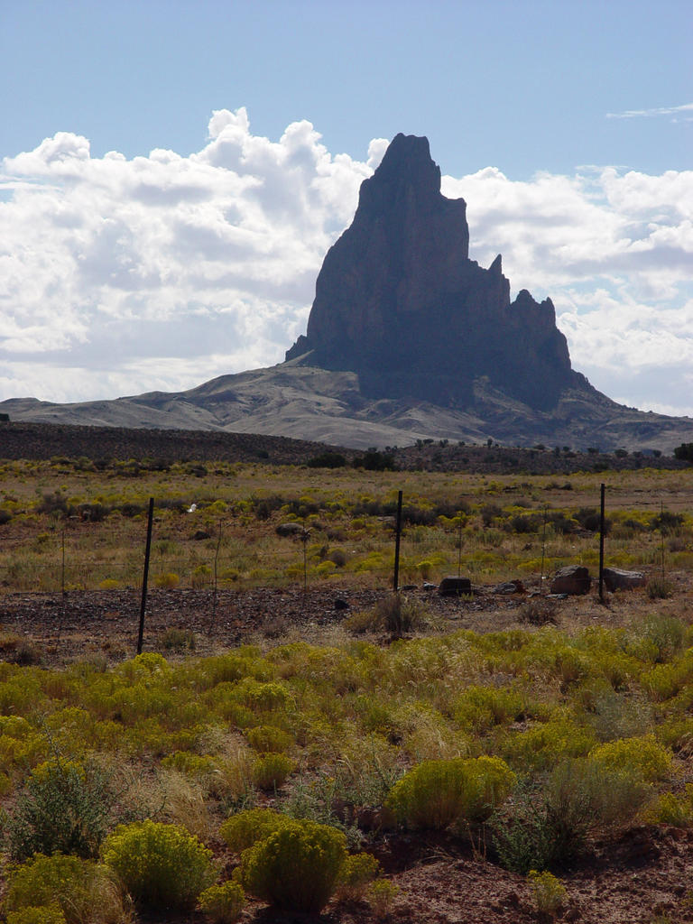
Going southeast from Lake Powell, the cliffs turn a
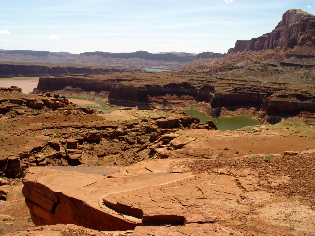
 blackish red color, but the valley floor is buff colored. This is the White Canyon area, and there are narrow white canyons and other holes in this valley floor. The red cliffs diminish after S. Junction 276, and the ground cover thickens with gray-blue scrub and junipers. The road turns east with the red mountains of Natural Bridges Park on the north side.
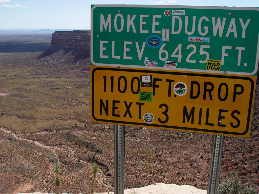
We drive south on 261 towards Mexican Hat. Junipers cover the land, but two to five foot high yellow, bushy flowers line the highway. Now comes the best part! I really wish they wouldn’t print cautions on maps for this area: Warning! Mokee
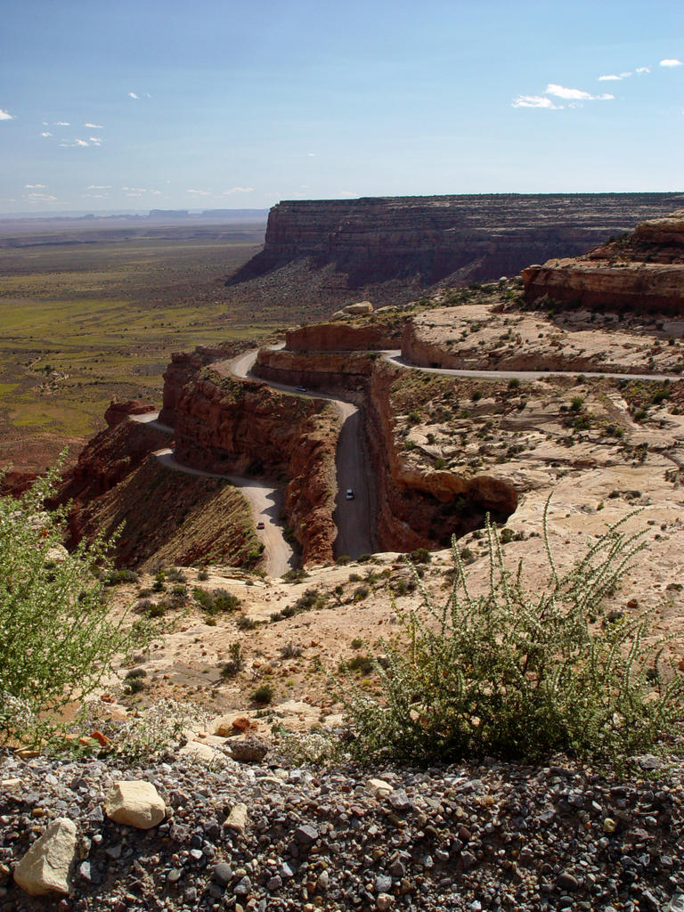
 Dugway is gravel with 10% grades and switchbacks for 3 miles! They make it sound like you’re going to drop off the edge of the world. Well, guess what? You are!
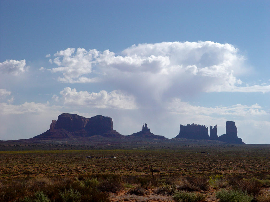
Giant, steep switchbacks drop off from narrow, gravel roads into Monument Valley, an immense, yellow-green plain stretching south all the way to the monuments, 40 miles away. We could actually see them in the distance, and the view is just awe-inspiring! The distance to the horizon is incredible. One minute, you’re driving along in your little world, thinking everything is OK, and then the next minute, that world goes away. It is a stunning view
 on a clear day.
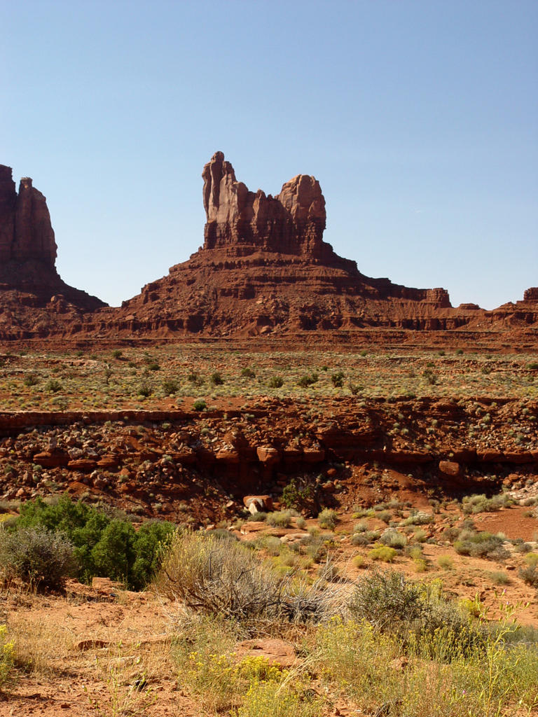
We travel southeast through the plain to Highway 163, then south to Mexican Hat, which gets its name from a little rock pinnacle that looks like a hat. The monuments to the south are dark hazy blue, silhouetted against a white hazy blue afternoon sky. We continue southwest to Gouldings. Cows are in the road as we take the turnoff west to Gouldings, a few miles above the Arizona border.
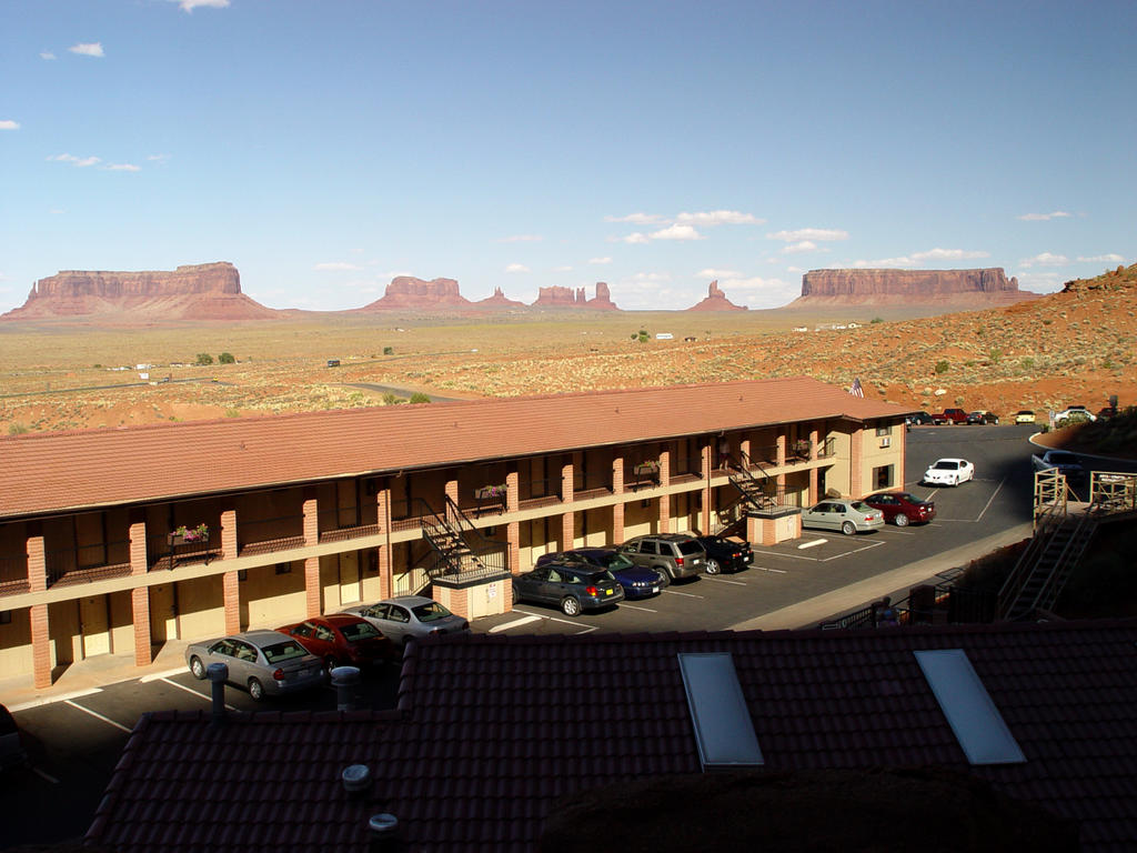
The main motel faces north and sits in front of a giant monument! It’s really cool! The place is really like a small town. There is a gift shop, museum, restaurant, laundry, car wash (Mark was ecstatic!), grocery store, a campground in between two monuments, and a plane out in front of the whole area! The long motel runs east and west, and every room has a balcony and a view. They also have little bus tours to see more of the monuments on the Indian lands.
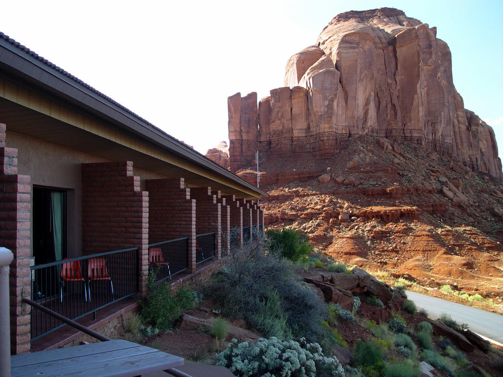
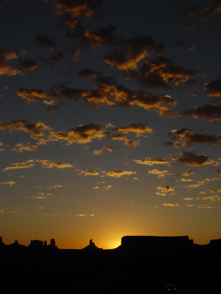
 Mark and I ate dinner, which was very good, and then sat outside. Our particular room led out onto a large, triangular patio made of red slate that sits atop a little rocky cliff. We are on the second level of the motel. The first building sits below us. As the sun goes down, the monuments get redder, and then headlights can be seen all over the yellow-green valley.
In the morning, Mark gets up early to take pictures of the sunrise coming up over the monuments. There are little fleecy clouds in the east, which add great color and interest to his shots. The monuments to the west turn bright red. Other
 people are standing on their balconies or walking out onto the large patio in front of our room.
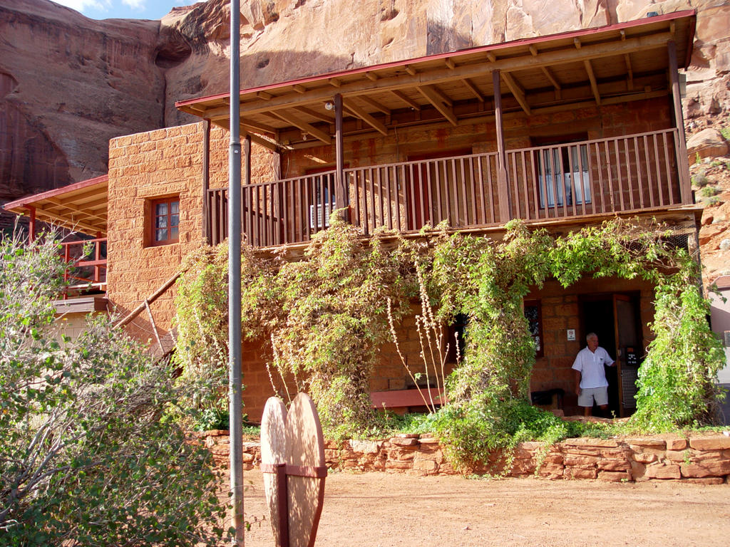
Later, we visited the museum, which is the original Gouldings Trading Post. It is very interesting, with many old pictures of the Gouldings, their Indian neighbors, and also movie stars from the old western movies made in the valley. The Gouldings lived on the 2nd floor of the trading post, and their belongings are still there, a really neat house.
Then it is time to get in the car and head south to Arizona, many other monuments, the Four Corners, and
 Mesa Verde!
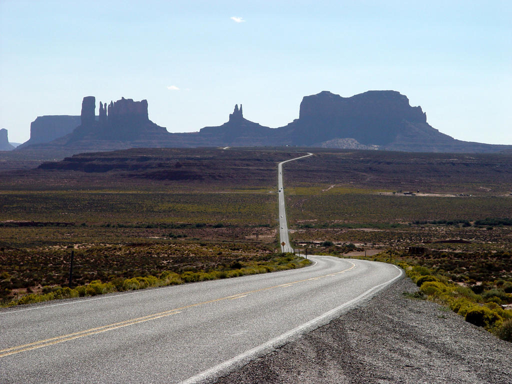


# posted by Unknown @ 7:09 PM 
![]()