Wednesday, February 01, 2006
Into the Mountains
 It is a beautiful day with high, wispy clouds. We are going east out of Montrose on Highway 50 through farm valleys with fields of corn. Mountains are all around us. Distant ones to the south are quite jagged. The northern ones come closer and look like giant mounds of tan dirt with a few junipers on top.
The road turns southeast with dirt hills on both sides now, but covered with scrub. The plants are gray, green, yellow-green, with blond grass, some junipers and small trees. The scrub is turning red and orange, the little trees yellow. It looks like fall. The road twists and turns through these hills while sheep graze in small green valleys on the south side.
At Cimarron the mountains rise on the north side with sharp shards of rock near the top. A river lined with tall trees and grass runs next to the road on the south. The trees are turning yellow, very pretty.
 The land flattens out some, into farms, with herds of sheep in the north running through meadows. There are mountains in the distance to the south, dark with trees. A small rock plateau rises up to the north. Round bales of hay lay in cut green fields while black cows graze in a pasture nearby. We pass a giant grassy valley on the south side with its own reservoir lake and herds of cattle grazing.
The road narrows and goes through close, sharp, rocky mountains. As we ascend, we see an array of large, rolling mountains crested with rock plateaus.
We cross the river near Sapinero, where there is a large dammed lake. The plateaued mountains to the north are called Blue Mesa, because their rolling sides are covered with blue-gray scrub.
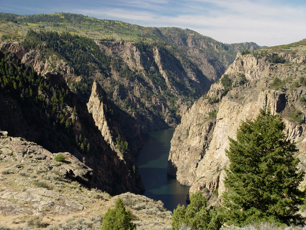
We turn back west now, onto Highway 92, which winds quite spectacularly around the north side of the steep, granite Black Canyon. Where they can get a foothold, pine trees grow on its sheer sides. We stop at some of the turnouts to look down into the dark, shade-filled canyon with a wide river at the bottom. It is a bright, sunny day. The rocks we walk on are covered with
 blue-green lichen. Yellow flowers grow here.
At one of the stops, we meet a young couple on a motorcycle who tell us about a restaurant up the road in Crawford. We talk for a while about our trip and car, and then move on. The mountains are covered with yellow-tinged birch, pines and reddish scrub. Every now and then we see small clusters of dark, tall, cone-shaped rocks, about twenty feet high. I have no idea what would make such a strange formation.
We cross the Montrose County line and turn north, ascending higher into the mountains.
 There are clumps of birch woods and pine, surrounded by multicolored scrub. Many mountains scenes, all beautiful.
The land levels out somewhat after a while. A small, long valley runs next to the road on the east side. Brown cows graze here in green pastures. Tall, yellow-tinged trees run through
 the valley, sparkling in the sunshine next to the farm buildings.
The farmlands continue through Maher and Crawford, with mountains on the east and west. We intended to stop in Crawford at the restaurant the motorcycle couple told us about, but it is closed. Instead, we go to the Branding Iron, a cute little golden brown wood building with outside decks surrounded by yellow birch. We are surprised when we see the motorcycle couple here also! Mark has been looking for a bar burger for ages. He finally gets his wish!
 Farms continue through Hotchkiss, where we turn northeast onto Highway 133. Some farms are dry, while others are green. They have little dammed-up ponds. The water in the reservoirs, lakes and ponds we see in this area is very low. Fruit and wine orchards grow near Paonia. On the south side of the road, a little man-made earth viaduct runs for a while through grass and shrubbery.
A railroad appears now in the south. The mountains around us narrow into a valley, with the railroad crossing over to the north in front of a giant coal mining operation near Bowie. A train with two old-fashioned black engines and about a hundred cars filled with coal sits in front of it. There are several mines from here through Somerset. One mine has a coal chute on the north side of the road that runs down over the road to the south side!
The road bends north, with a dammed-up river below on the southeast side. Pines grow on buff-colored rocky mountains
 now, both sides of the road. At the bend, we caught site of very high, jagged steep mountains to the east. They are light gray on top with sparce trees becoming thicker at base.
As the valley widens out, the mountains become more rounded and rolling, with grass, scrub, pines and birch. We come to a hairpin turn facing south, with a little road going to Marble that runs into a spectacular mountain valley. I wish we
 could have gone down there to see what it was like. One of our maps says there are marble quarries there.
The road turns north again, going through many steep-sided mountain valleys with a rocky river running below. Rocks alternate between red and white, half covered with trees. It is a pretty tree-lined river with beautiful views.
We pass Redstone, aptly named, coming up to Carbondale. There are several old coke ovens on the side of the road at Redstone. Most of the metal doors on the fronts have been broken off.
 The valleys widen out into farms again near Carbondale.
We turn northwest onto Highway 82. There are red mountains to the east and red and white striped mountains on the west. We come to Glenwood Springs, an old hot springs resort town, and now also a college town. It has nice upscale shops and old houses.
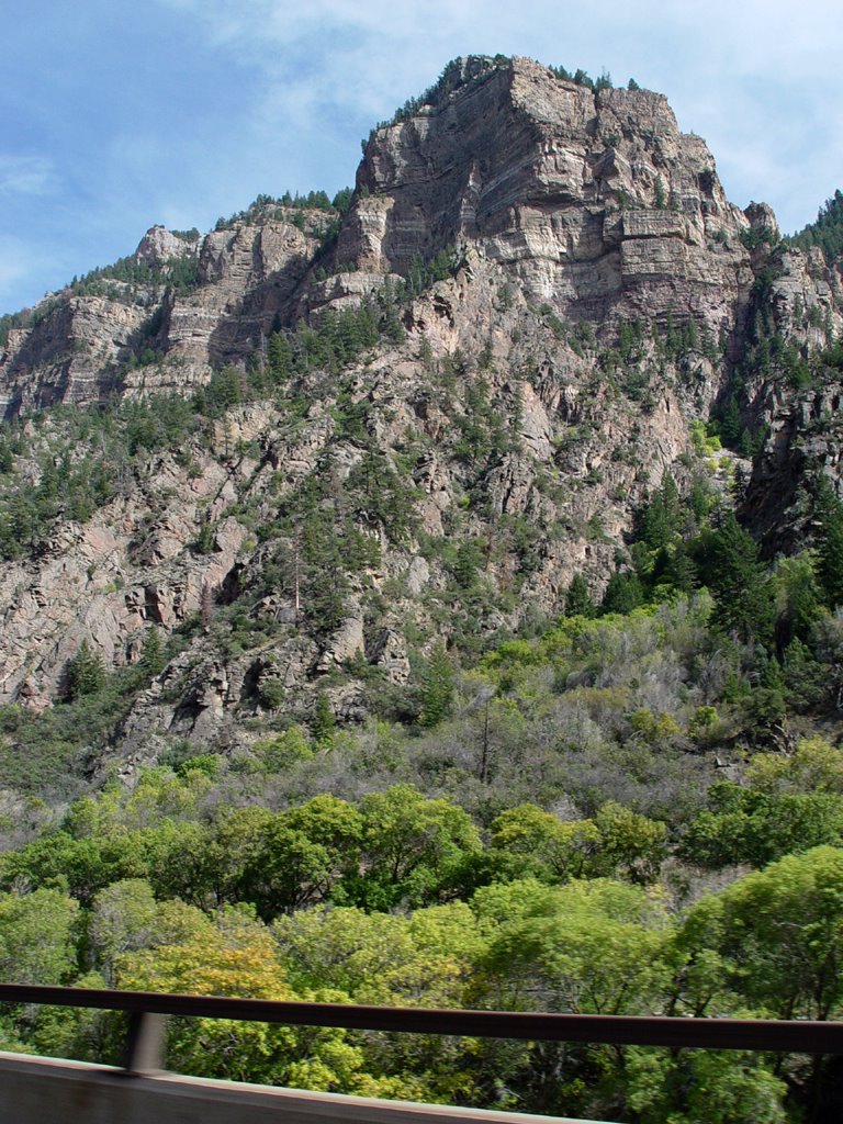
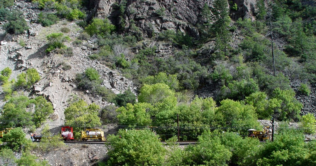
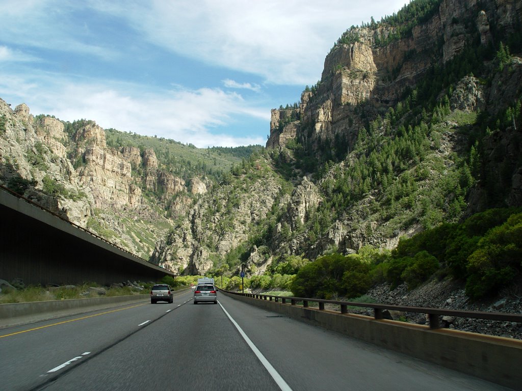
We drive east on Highway 70 into fantastic brown cliff canyons. This is the Glenwood Canyon. There is a large river on the south side of the road, along with a railroad track. The old power lines alongside the track have glass insulators on them. The tracks go in and out of blackened holes in the mountains. The highway splits into two pieces and is now double-tiered, one side higher up the north canyon wall than the other side as we go through tunnels. It is a very interesting ride.
The canyon ends near Dotsero, and the valley widens out into rounder, lower mountains. We go south on Highway 6 at Gypsum, then head east. There is a large gypsum mine here (who’d a thunk?) with white hills of gravel-like gypsum in front of white mountains on the north side of the road. A train is there with many cars full of gypsum. We continue east to Eagle where we spend the night.
![]()