Wednesday, February 01, 2006
Into the Mountains
 It is a beautiful day with high, wispy clouds. We are going east out of Montrose on Highway 50 through farm valleys with fields of corn. Mountains are all around us. Distant ones to the south are quite jagged. The northern ones come closer and look like giant mounds of tan dirt with a few junipers on top.
The road turns southeast with dirt hills on both sides now, but covered with scrub. The plants are gray, green, yellow-green, with blond grass, some junipers and small trees. The scrub is turning red and orange, the little trees yellow. It looks like fall. The road twists and turns through these hills while sheep graze in small green valleys on the south side.
At Cimarron the mountains rise on the north side with sharp shards of rock near the top. A river lined with tall trees and grass runs next to the road on the south. The trees are turning yellow, very pretty.
 The land flattens out some, into farms, with herds of sheep in the north running through meadows. There are mountains in the distance to the south, dark with trees. A small rock plateau rises up to the north. Round bales of hay lay in cut green fields while black cows graze in a pasture nearby. We pass a giant grassy valley on the south side with its own reservoir lake and herds of cattle grazing.
The road narrows and goes through close, sharp, rocky mountains. As we ascend, we see an array of large, rolling mountains crested with rock plateaus.
We cross the river near Sapinero, where there is a large dammed lake. The plateaued mountains to the north are called Blue Mesa, because their rolling sides are covered with blue-gray scrub.
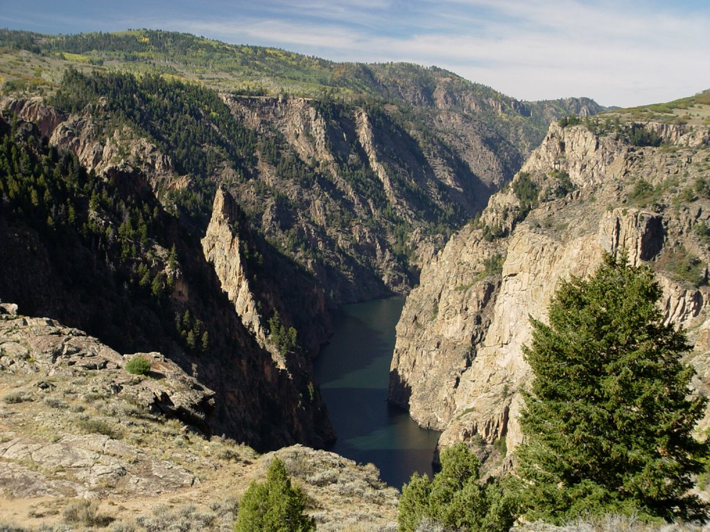
We turn back west now, onto Highway 92, which winds quite spectacularly around the north side of the steep, granite Black Canyon. Where they can get a foothold, pine trees grow on its sheer sides. We stop at some of the turnouts to look down into the dark, shade-filled canyon with a wide river at the bottom. It is a bright, sunny day. The rocks we walk on are covered with
 blue-green lichen. Yellow flowers grow here.
At one of the stops, we meet a young couple on a motorcycle who tell us about a restaurant up the road in Crawford. We talk for a while about our trip and car, and then move on. The mountains are covered with yellow-tinged birch, pines and reddish scrub. Every now and then we see small clusters of dark, tall, cone-shaped rocks, about twenty feet high. I have no idea what would make such a strange formation.
We cross the Montrose County line and turn north, ascending higher into the mountains.
 There are clumps of birch woods and pine, surrounded by multicolored scrub. Many mountains scenes, all beautiful.
The land levels out somewhat after a while. A small, long valley runs next to the road on the east side. Brown cows graze here in green pastures. Tall, yellow-tinged trees run through
 the valley, sparkling in the sunshine next to the farm buildings.
The farmlands continue through Maher and Crawford, with mountains on the east and west. We intended to stop in Crawford at the restaurant the motorcycle couple told us about, but it is closed. Instead, we go to the Branding Iron, a cute little golden brown wood building with outside decks surrounded by yellow birch. We are surprised when we see the motorcycle couple here also! Mark has been looking for a bar burger for ages. He finally gets his wish!
 Farms continue through Hotchkiss, where we turn northeast onto Highway 133. Some farms are dry, while others are green. They have little dammed-up ponds. The water in the reservoirs, lakes and ponds we see in this area is very low. Fruit and wine orchards grow near Paonia. On the south side of the road, a little man-made earth viaduct runs for a while through grass and shrubbery.
A railroad appears now in the south. The mountains around us narrow into a valley, with the railroad crossing over to the north in front of a giant coal mining operation near Bowie. A train with two old-fashioned black engines and about a hundred cars filled with coal sits in front of it. There are several mines from here through Somerset. One mine has a coal chute on the north side of the road that runs down over the road to the south side!
The road bends north, with a dammed-up river below on the southeast side. Pines grow on buff-colored rocky mountains
 now, both sides of the road. At the bend, we caught site of very high, jagged steep mountains to the east. They are light gray on top with sparce trees becoming thicker at base.
As the valley widens out, the mountains become more rounded and rolling, with grass, scrub, pines and birch. We come to a hairpin turn facing south, with a little road going to Marble that runs into a spectacular mountain valley. I wish we
 could have gone down there to see what it was like. One of our maps says there are marble quarries there.
The road turns north again, going through many steep-sided mountain valleys with a rocky river running below. Rocks alternate between red and white, half covered with trees. It is a pretty tree-lined river with beautiful views.
We pass Redstone, aptly named, coming up to Carbondale. There are several old coke ovens on the side of the road at Redstone. Most of the metal doors on the fronts have been broken off.
 The valleys widen out into farms again near Carbondale.
We turn northwest onto Highway 82. There are red mountains to the east and red and white striped mountains on the west. We come to Glenwood Springs, an old hot springs resort town, and now also a college town. It has nice upscale shops and old houses.
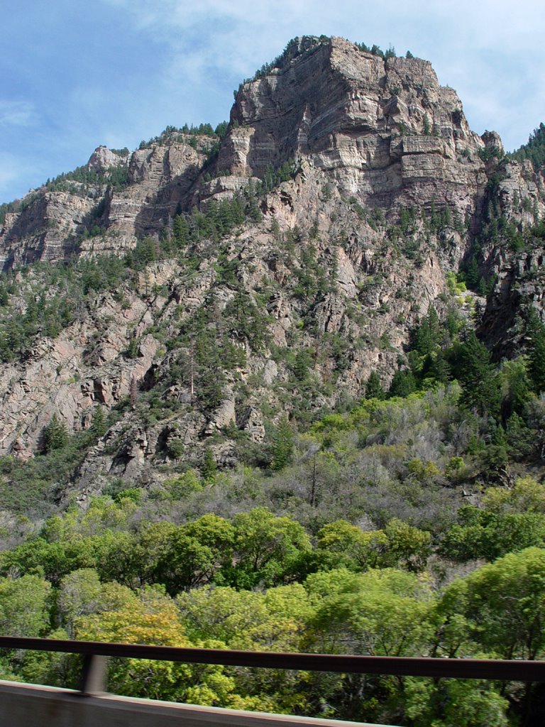
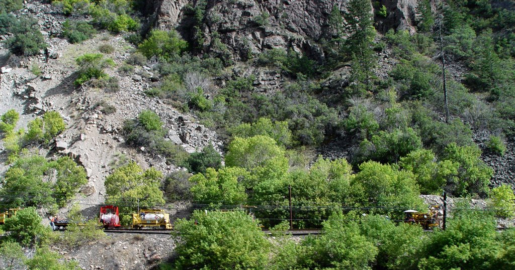
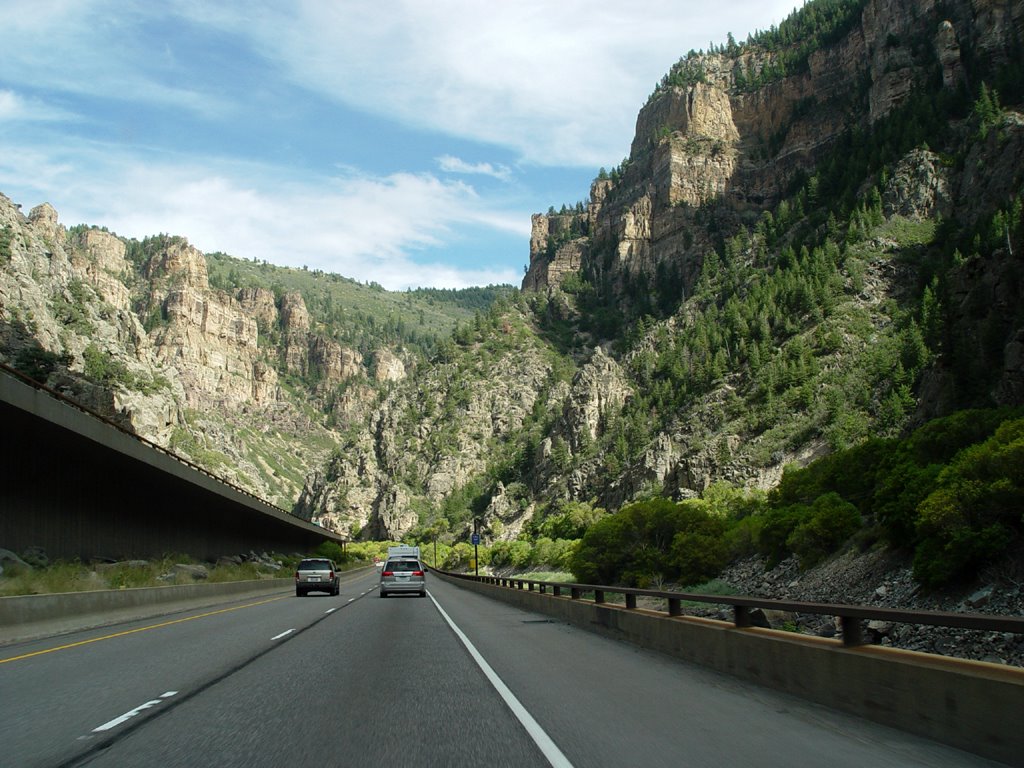
We drive east on Highway 70 into fantastic brown cliff canyons. This is the Glenwood Canyon. There is a large river on the south side of the road, along with a railroad track. The old power lines alongside the track have glass insulators on them. The tracks go in and out of blackened holes in the mountains. The highway splits into two pieces and is now double-tiered, one side higher up the north canyon wall than the other side as we go through tunnels. It is a very interesting ride.
The canyon ends near Dotsero, and the valley widens out into rounder, lower mountains. We go south on Highway 6 at Gypsum, then head east. There is a large gypsum mine here (who’d a thunk?) with white hills of gravel-like gypsum in front of white mountains on the north side of the road. A train is there with many cars full of gypsum. We continue east to Eagle where we spend the night.
Monday, January 23, 2006
The Colorado River
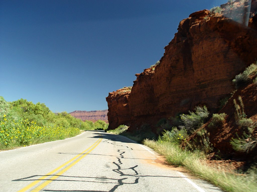
 After our brunch at Eklectica in Moab, we set out on Highway 128, which travels northeast right next to the Colorado River. It is a winding, picturesque road with towering red-black cliffs and plateaus on either side. The road runs along the south shore. There are lush green trees and grasses along the river’s edge, and we come across a campground near the Big Bend area.
As we drive along, we see a place where we can walk down to the river. We stop the car in a parking lot and walk down to a light-colored sandy, gravely beach spot. It’s very pretty with green trees to the right. There are some people
 lounging there with their picnic. Some yellow plastic rafts drift by, sliding to the left. In these two rafts, along with the people, are three dogs! At first, I think the people are going to paddle up to the beach, which seems to excite the dogs very much. I’m not quite sure why, but the people change their minds and row away instead. Poor doggies!
We continue with our trip. All along the road, side canyons, wide and narrow, twist down to the river. They are jagged and quirky, filled with spires and chunky boulders. After a while, the land flattens out a bit. Somewhere in this stretch,
 we pass at least two very elegant and expensive-looking dude ranches. One has extensive white-railed paddocks for horses. The ranches have elaborate gates and plantings near the road. Very fancy-schmansy!
We leave the ranches behind. Off in the distance to the east, we see some unusual spiky rock pillars. They are thin, red sheets of rock-wall jutting out from a monument plateau. We take a side road that leads up to their base. These are the Fisher Towers, which contain many hiking trails. The afternoon is very hot, so we just stop the car near some other tourists to take a quick
 look. As we are viewing the towers, Mark realizes that there are at least two people that have climbed up to the top of one of them! We have no idea how they got up there, or, better yet, how they are going to get down! If you look very closely at the middle of the fifth picture in this series, you will see them. Perhaps they are still there . . .
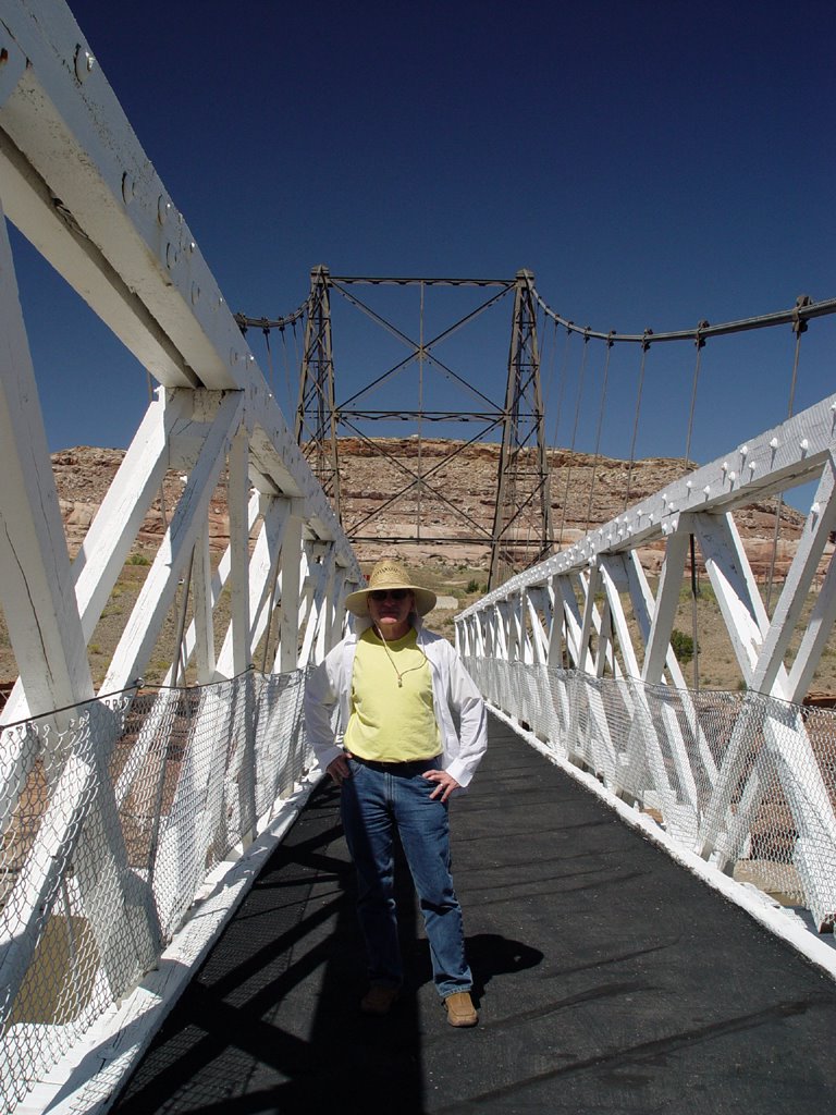
Highway 128 zigzags north after the Fisher Towers and passes over the Colorado River at Dewey. The original small suspension bridge still stands alongside the newer highway. The old tourist stores and picnic areas of Dewey are on
 the north side. The man that ran the stores is still there, in a house down the hill next to the river.
Rising up from the Colorado, we turn northwest and ride into . . . absolutely nothing! There are no houses, no plants. There is only the road. There are a few low, round hills and small ridges covered with short, light scrub and grass, but that is all. As far as the eye can see, there is nothing. This is called the Grand Valley, but it looks like a vast, flat plain.
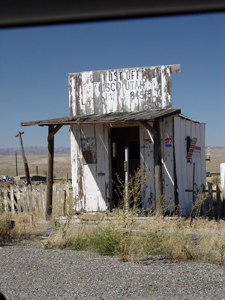
We turn northeast and come to the abandoned town of Cisco. The dilapidated, caved-in buildings sit in grassy, uncut fields—but wait! There are new cars here! People still live in this town.
We drive past Cisco northeast onto Highway 70 into the nothing again. Pink mountains topped with darkness rise off to the north, pink plateaus are in the southeast. Near the Colorado border, dark green junipers dot the pure blond
 grass, shining brightly in the sun. It makes for a strange landscape.
At the border, the junipers increase on low hills. Wide rolling valleys appear with low rocky plateaus of beige sparsely covered with juniper. Blond grass with light scrub and a few flowers cover the valley floors.
To the north, irrigated farms and a town sit in a vast, flat valley edged by pink and white mountains. At Mack, the road turns southeast to Loma. The road is bordered on the south by rounded, blond grass hills. At Loma, banded pink
 plateaus rise up in the south, with the wide Gunnison River near the road.
We come to Fruita. The plateau cliffs and canyons to the south are quite large and interesting, with blond hills at their base. To the northeast, a range of light pink and tan mountains looks like a gravel pit! Grand Junction is next, a big city with Sears and Walmart. We switch to Highway 50 here, and continue southeast.
Near Whitewater, a series of weird little yellow and white sand hills commence on the east side of
 the road. Large mountains dark with junipers stand behind them. This landscape continues all the way to Delta and Olathe. To the west, widely scattered houses, each with their own little enclave of items, are stationed on a wide, blond grass plain.
As we approach Delta, we notice a low, white cloud in the distance, going from west to east crossing the road. It is thick in the west, thin and hazy in the east. It looks like smoke. Delta has an odd landscape of tiny, gray rock canyons sunk into the ground here and there near the road.
Farm fields and trees cover the land to the west after we leave Delta. The east has some farms also, along with those weird yellow sand hills. We smell the smoke! Over the southwest horizon, there is a national forest. We assume that is where the fire is located.
We are at Olathe. Smoke covers the entire southern horizon.
 The countryside is fairly settled now, with farms, scattered trees and houses. The land is mostly flat with mountains still to the east. The mountains in front of us to the south are barely visible through the smoke.
We come to Montrose, where we will stop for the night. Tomorrow, we will turn east and head up into the mountains.

Monday, December 05, 2005
Moonset over Moab
 It is morning, but not morning. Outside in the dark, the full moon sets over a monument on the outskirts of town. It falls just below the top cliff, creating a soft white glow above it. The hours before daylight are cool and still as we drive north to Arches National Park.
The road is long from the entrance to the end, where we will walk the Devils Garden. The moon, still with us, is now a deep orange-yellow, like a pumpkin. Small, brown rabbits dart across the road. Their round eyes glare brightly in the headlights. They are everywhere! Remembering the heat and barren rocks of this park from
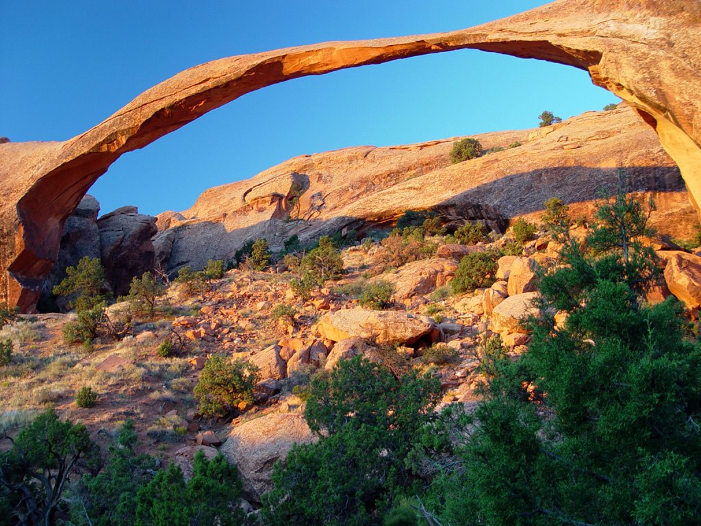 yesterday afternoon, it is hard to believe that so much life could be here.
False dawn arrives as we come to the end of the line, the Devils Garden Trailhead. We start our walk just as we can see the path ahead of us. It would be nice to have more light, but the largest arch, Landscape Arch, is about a mile away, and we want to see it at sunrise. The rabbits are jumping and running all over the place! We try to take pictures of them, but because the light is so low, the shots don’t come out very well.
Yesterday I was disappointed with the park
 when we found out we would have to walk quite a ways to see the big arches. It was hot and bright, and as the day heats up, the wind rises also. But timing our visit for the morning makes all the difference. The walking is quite pleasant with many interesting tree and rock formations.
We arrive at Landscape Arch before the sun comes up. There is a little side trail that gets closer to it, so we go on that to take more pictures. Just as we are about to leave, the dawn breaks over the arch, lighting it up like gold! The rocks turn rich and vibrant, and as we walk along to other arches, this gold lights them up inside.
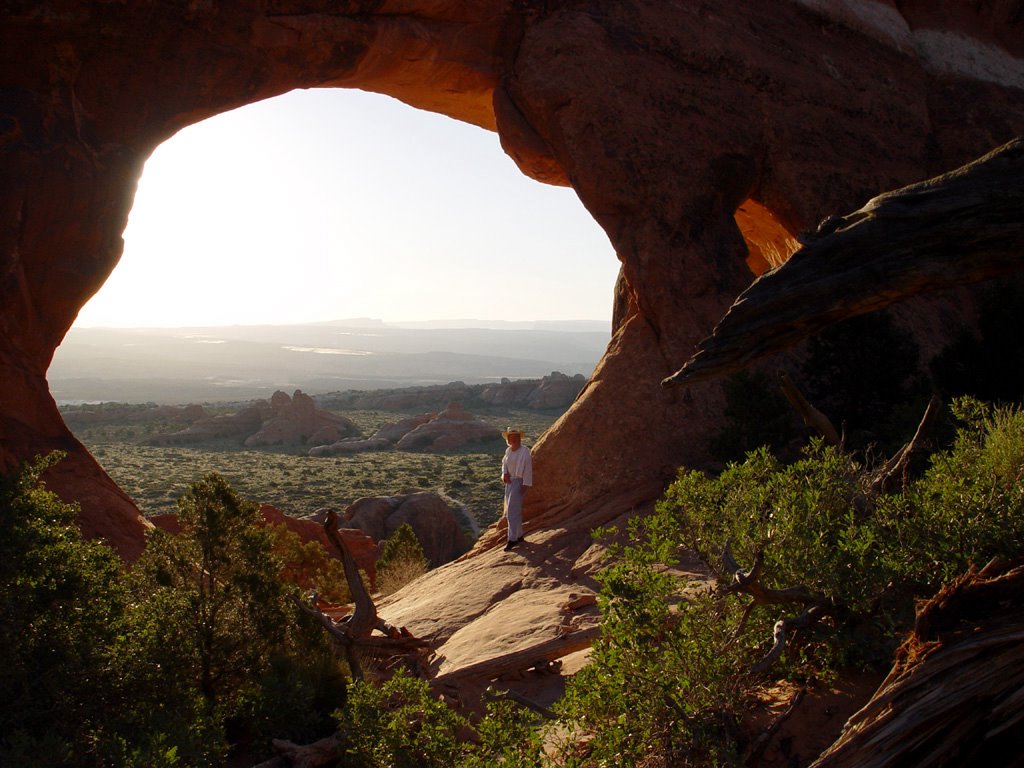 The landscape comes alive with deep shadows and colors against a clear blue sky.
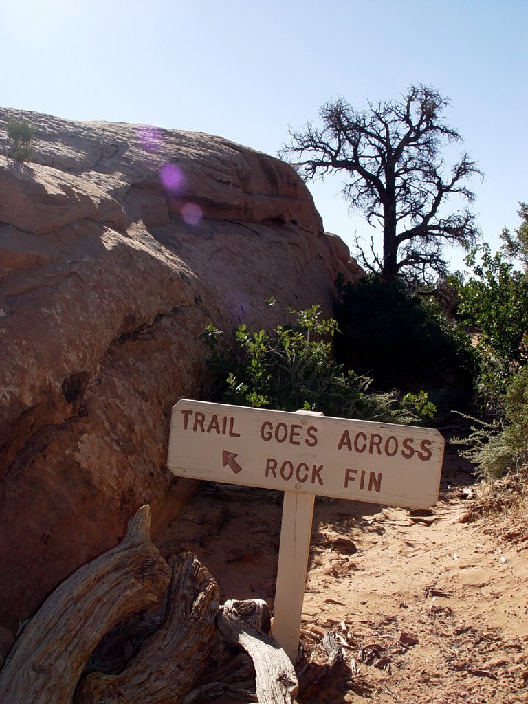
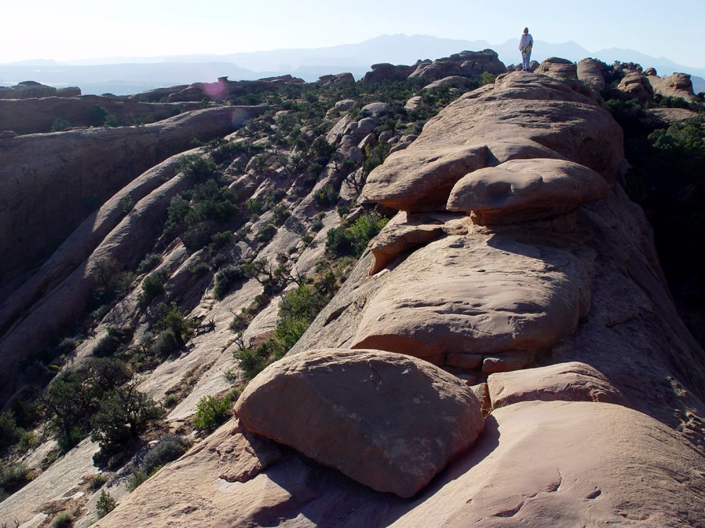
For about an hour, we are alone in the park. It’s great for taking pictures! Then one guy shows up and wanders off ahead of us. Later on we meet another man with a large tripod and camera. We come to a split in the trail near Double O Arch. Here we can circle around and go back a different way, but we decide not to. The circle trail is longer, and we have already walked at least three miles one way.
About half way back, we finally see more people
 coming along toward us. The sun is high, it is getting quite warm, the wind is starting to pick up, and everyone is just hitting the trails! I am glad we came so early. It was a very peaceful, relaxing and beautiful way to see this park.
We end our trek by going out to brunch at a wonderful little café in Moab called Eklectica. Wide-roofed porches with outdoor seating and gardens surround the shop. A giant blue mosaic encrusted coffee cup makes for great advertising in the front garden next to the road. It’s a great place for rest and refreshments after our long hike!


Tuesday, November 29, 2005
Junkyard Dogs and Hole N' The Rock!
 They say that Ouray is open to tourists all year long, but some of the businesses in town do close at the end of summer. In the morning, we decide to visit a bakery we read about in one of the tourist brochures, but when we get there it is closed for the season, on account of the baker going to Africa for the winter! (That’s gotta tell you something about the weather here.) There are bars and restaurants, but it is hard to find anything open for breakfast. We finally go into a spacious, sunlit coffee shop with many blond wood tables and a very long line of people waiting for service. There is a lone worker behind the counter, taking orders and running around like
 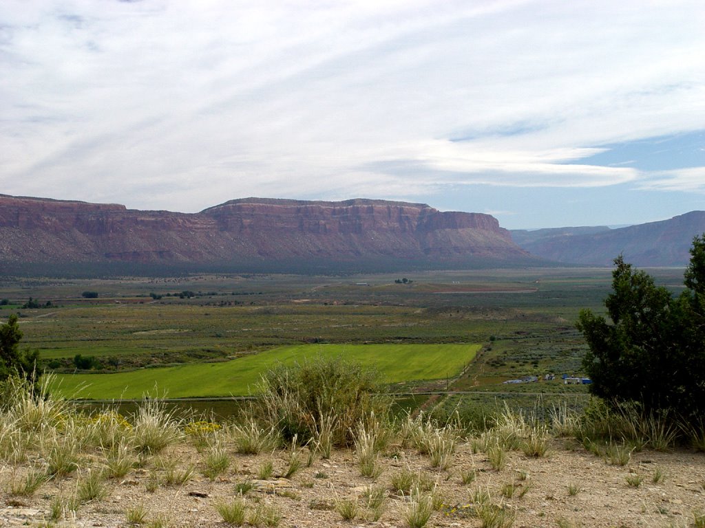 mad. Mark is not happy. Mark does not like to wait for anything. If Mark had his way, we would never eat, except maybe once a day, when he could get a martini with his dinner. However, we do wait, because divorces are expensive.
We eventually obtain good coffee and pastries, and then Grumpy and I set off into the unknown on our next leg of the trip. We come out of Ouray’s bowl-like mountain valley and head north on Highway 550 to Ridgway. The mountains get smaller while the valley widens into farms and pastures. At Ridgway we turn west on 62. It is a sunny, clear day as we drive
 through farm valleys with giant rolls of hay in the fields. A row of high mountains lay behind them to the south.
We go southwest into rounded green mountains, and meadows bordered with aspen forests. The aspens start to mix with pine and blue spruce as the valley becomes narrower and meadows diminish. The mountains show more rock now. It is blocky and chunky looking, white and red.
Placerville sits in a narrow river valley along the south side of 145 going northwest to Norwood. The road runs above the town on the north. Chunky red rock cliffs line both sides of the valley with a pretty stream running through the middle.
High, thin clouds form bands in the sky as the valley widens. The mountains round and change to pinkish tan. The road crosses the river, then rises up sharply to the mountaintop on the southwest side. A grassy pastureland covers the high plateau. Norwood and Redvale are both ratty
 little towns with small houses. Junky farms are scattered about. There are high, pointed mountains to the west with lower, longer mountains to the north and south.
Near Junction 141 just before Naturita, desert plants start to take over! We see junipers, blue-gray shrubs and yellow-flowering bushes again. Naturita is another junky town! Junkyards are all over, with more ratty houses and many rusted cars. I guess people like to keep their own personalized dumps here. You never know when you might need to recycle something!
 We turn northwest onto 90 at Vancorum and drive through rocky tan mountains that turn down into a wide valley. This valley runs northwest for miles all the way to Paradox. There are long flat mountains dotted with junipers to the south, while the north is dominated by a long, red and white banded rock plateau. The valley starts with desert scrub and junipers and ends with farms. At Paradox, the road twists up over the southern mountains into red and white rocky cliffs, very picturesque.
We pass over into Utah, going west on 46 up into white, chunky pine-covered cliffs. They end in
 grassy plains with farmland and trees stretching north up the sides of a beautiful set of rounded mountains with bare tops. These are the La Sal Mountains, and we circle them as we continue west and then north on 191. We view their pretty green meadows and forests from many angles as we travel along.
On 191, the country changes completely to red rock canyon lands! Then we see something quite amazing. It is Hole N’ The Rock! We know this because there are giant, white letters about 20 feet high painted on the side of a small, red mountain right next to the side of the road. This
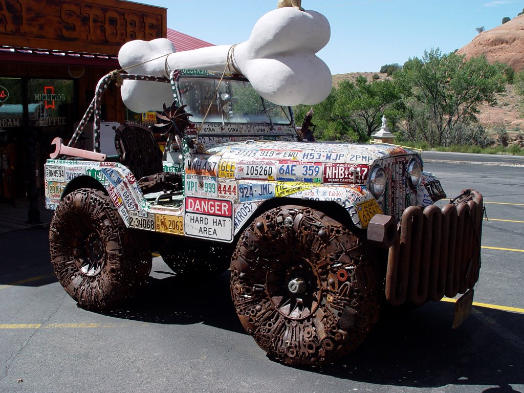 tourist trap has every kitschy thing you can imagine. It also has a house with regular windows and doors built into the rock!
There is a small pool filled with plants and sculptures, many cactus gardens filled with statues and other various objects, a zoo and a trading post. And of course, the Hole N’ The Rock, which started out as a small restaurant. Albert, the guy who made it, just kept blasting out more rock until he turned it into a house.
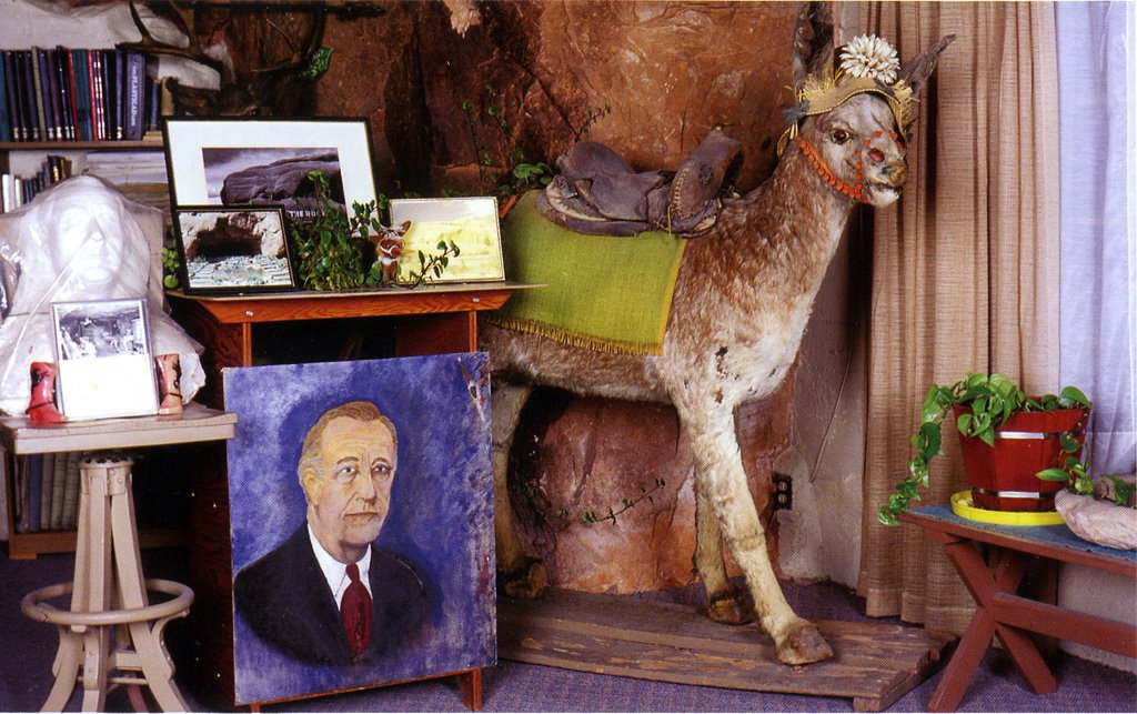
Albert had many hobbies including painting and sculpture, which he got pretty good at. Then he
 tried his hand at taxidermy. Boy, he should have left that one alone. Poor donkeys! He didn’t kill them; they were the donkeys he used to carry out the rock after blasting. When they died, he decided to stuff them, and they can still be seen inside the house today. This whole place is an unusual, fun area to visit.
We continue north to Moab, a large tourist town surrounded by red rock desert. We check into a hotel, then drive up to Arches National Park. We find out that although there are many interesting rock formations, most of the arches are at the very end of the park and you have to walk about
 five miles round trip to see them! It is afternoon and very hot, so we decide to do this tomorrow morning.

Thursday, October 13, 2005
The Million Dollar Highway
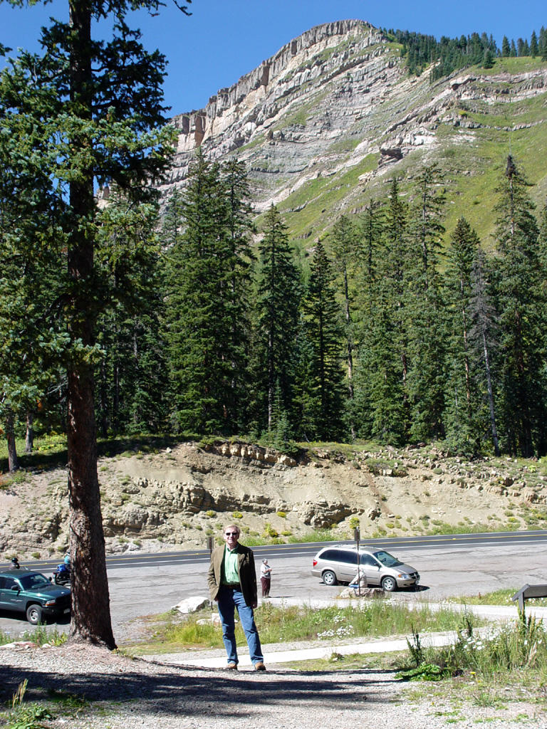
 The day is cool, very clear, with no clouds. We head east for Durango on Highway 160. There are tall mountains in front of us, covered in pine. They look dark, backlit by the morning sun. We drive toward them through hilly, treed plains with blond pastures and green farmland where cows and horses graze, a land of lush trees and streams.
We pass through Mancos and rise up into the mountains, with green valleys and farms in view down below. The mountains are covered with tall pines and other trees. Green grass has replaced
 desert scrub. Cows graze in mountain pastures.
There are rows of blue hazy mountains in the east as we go by Hesperus and drive down into a valley. The valleys and mountains continue, pine-covered, rocky and narrow.
We come to Durango, a pretty town with the sparkling La Plata River running through it. We eat breakfast at Le Rendezvous, a great gourmet restaurant and bakery in the historic district. I had French toast made out of a sliced baguette, with blueberries. Two divorced high-maintenance broads sat near us, talking about their bad husbands, work and kids! Afterwards, we walked around town and bought an aspen leaf
 picture in a very nice high-end art and furniture shop.
After breakfast, we drive north on Highway 550, the Million Dollar Highway. There are two theories about this name. One is that it cost a million dollars to make the road; the other is that a woman said she wouldn’t go back there again for a million dollars! Personally, I think it is spectacular.
We travel through rounded pine-covered mountains, thickly banded with dark red and white rock. A white glider flies through the valley, landing at a small roadside airport. We pass through Honeyville, set up as an old-timey railroad town, complete with train and large tan-painted wood water tower for the train. A large herd of cattle graze nearby.
We drive halfway up the west side of a larger valley. In this valley there are long, narrow, lumpy, rocky ridges running along through the middle. These dark ridges are topped with expensive, million dollar houses. It is an oddly unique
 landscape, but very beautiful.
We go up higher now into splendid, pointed mountains with tall, skinny pines and aspen. We take pictures at Coal Bank Pass and before Lime Creek Burn. We cross the Molas Divide and head down out of the mountains into Silverton, a small, pretty Victorian town in a flat valley.
Then we head up through higher mountain valleys again. We have seen hillsides of pine poles laid down flat, probably from avalanches. Between the pines there are open patches of brown, rust and deep yellow gravel on the mountainsides. There are no guardrails on the sides of steep drop-offs. Sneeze once driving a Mini Cooper and you’re done for!
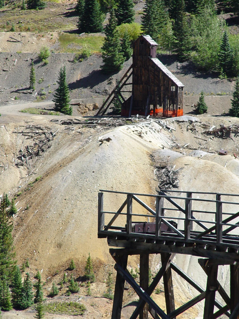
In the Red Mountain area, old wooden mine shafts appear. There is one large one in particular halfway up the mountain, with old mine tailings running down into the river. We see some fall color on the hills, yellow aspens with the
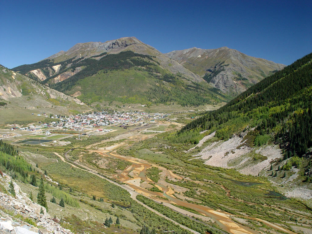 pine. We stop in the valley to take pictures. There is a high railroad trestle for loading ore, and some white clapboard houses, probably for the workers or mine company officials.
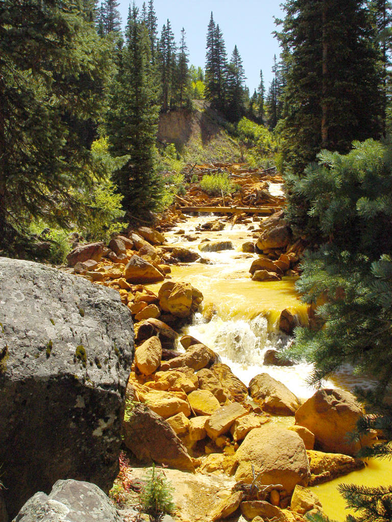
We continue north on 550. A little way past the mines a bright yellow river runs next to the road! The surrounding rocks are also dyed yellow, possibly pollution from the mines? Part of a snowdrift still lies in the riverbed!
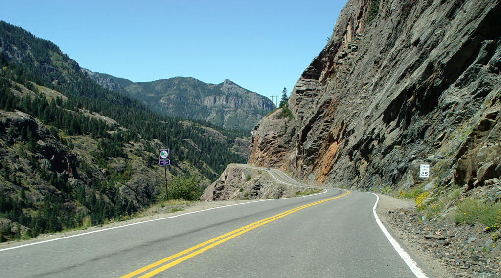
As we drive on, the mountains become solid gray, bare rock with sheer drop-offs and no guardrails. Michigan authorities would be
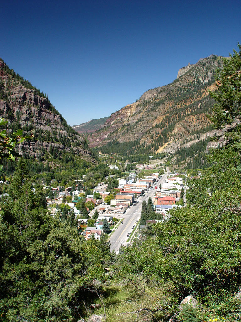
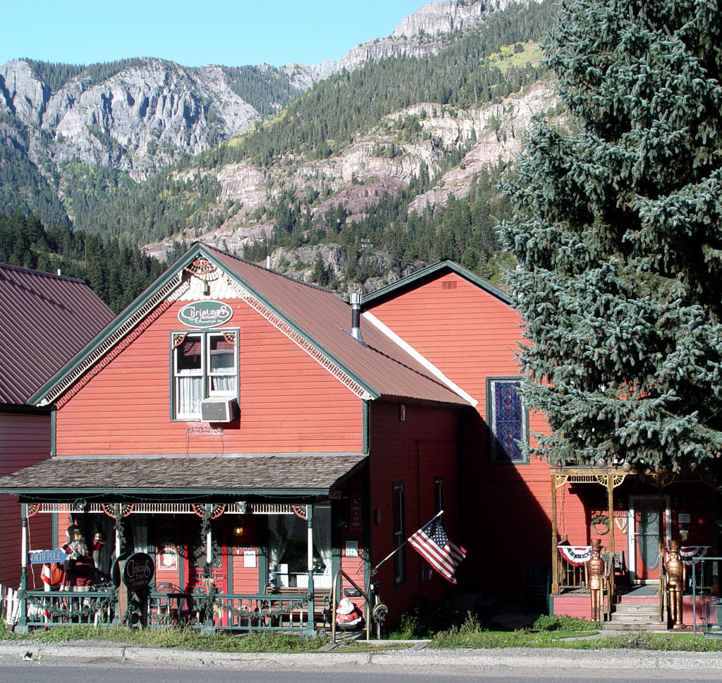
 appalled! We are about to descend into Ouray (pronounced You Ray), the Switzerland of America.
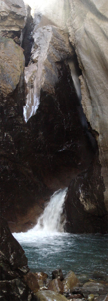
Before we go into the town, we take the turn-off to see Box Canyon, a narrow fissure between high rock cliffs with a spectacular waterfall running through it. This tourist attraction is at least 100 years old, because we actually have pictures of it in our stereograph collection!
You see the falls and river via a metal mesh walkway hung halfway up the fissure wall inside
 the canyon. Because this small canyon is so narrow (only a few feet wide in places) it is mostly dark inside. At the back of the canyon there is a stairway to the river below.
The falls rush down, then turn like a waterslide around a giant rock column, with a final mighty cascade into a circular pool. The crystal clear water runs through the fissure over rocks and around boulders until it leaves the little canyon. It is an absolutely beautiful display. You can take another walk up to the top of the falls where you can look down through the fissure as the water rushes around the rock column slide.
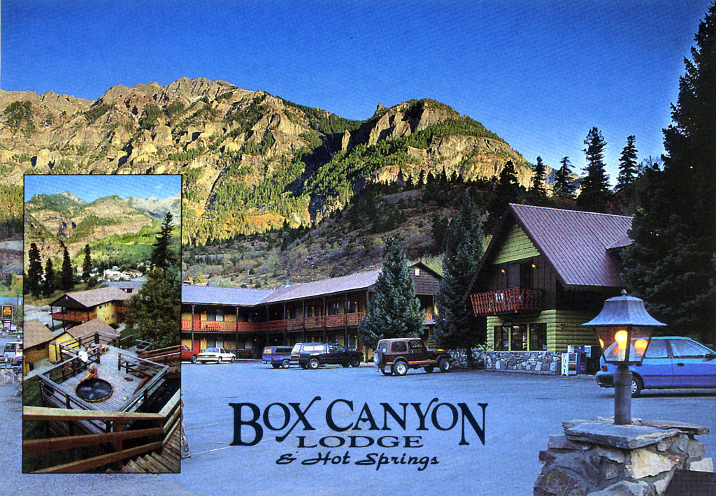
After seeing the falls, we drive into Ouray and stay at the Box Canyon Lodge, complete with hot tubs on the mountainside! While we enjoy the wooden tub on its little deck, a deer walks by on the hill behind us. The motel takes its water from a hot spring running down the hillside, reduces its temperature from 140 degrees, then pipes it into
 the tubs. In fact, Ouray is known for its hot springs. Many of the hotels have hot tubs, and there is a giant, public hot spring pool on the north side of town.
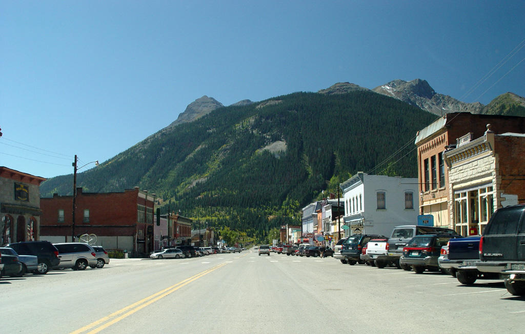
We walk into town for dinner that evening. Ouray is an old Victorian town with beautiful, ornate houses and highly decorated town buildings. We eat dinner at the Bon Ton Restaurant in the basement of the St. Elmo Hotel. The side entrance of the hotel is reached by walking through a patio filled with tables topped with umbrellas, which are surrounded with plants and trees lit up with soft white lights.
We sat for a while in the elegant main parlor of the hotel until our table was ready, and then went downstairs to the beautiful red brick and timber restaurant. The food and drinks were superb. Mark was very impressed with the quality of the martinis!
 We relaxed in the hot tub again after dinner, with another deer and fawn grazing on the side of the hill above us. Ouray is a beautiful place, and we thoroughly enjoyed our stay here!
Tomorrow we will drive down out of the mountains and head northwest into the desert again to Moab and Arches National Park!


![]()