Thursday, October 13, 2005
The Million Dollar Highway
 The day is cool, very clear, with no clouds. We head east for Durango on Highway 160. There are tall mountains in front of us, covered in pine. They look dark, backlit by the morning sun. We drive toward them through hilly, treed plains with blond pastures and green farmland where cows and horses graze, a land of lush trees and streams.
We pass through Mancos and rise up into the mountains, with green valleys and farms in view down below. The mountains are covered with tall pines and other trees. Green grass has replaced
 desert scrub. Cows graze in mountain pastures.
There are rows of blue hazy mountains in the east as we go by Hesperus and drive down into a valley. The valleys and mountains continue, pine-covered, rocky and narrow.
We come to Durango, a pretty town with the sparkling La Plata River running through it. We eat breakfast at Le Rendezvous, a great gourmet restaurant and bakery in the historic district. I had French toast made out of a sliced baguette, with blueberries. Two divorced high-maintenance broads sat near us, talking about their bad husbands, work and kids! Afterwards, we walked around town and bought an aspen leaf
 picture in a very nice high-end art and furniture shop.
After breakfast, we drive north on Highway 550, the Million Dollar Highway. There are two theories about this name. One is that it cost a million dollars to make the road; the other is that a woman said she wouldn’t go back there again for a million dollars! Personally, I think it is spectacular.
We travel through rounded pine-covered mountains, thickly banded with dark red and white rock. A white glider flies through the valley, landing at a small roadside airport. We pass through Honeyville, set up as an old-timey railroad town, complete with train and large tan-painted wood water tower for the train. A large herd of cattle graze nearby.
We drive halfway up the west side of a larger valley. In this valley there are long, narrow, lumpy, rocky ridges running along through the middle. These dark ridges are topped with expensive, million dollar houses. It is an oddly unique
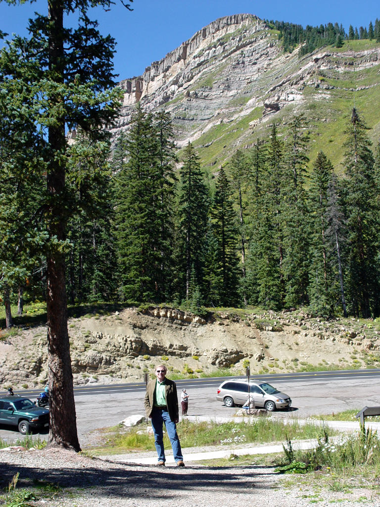 landscape, but very beautiful.
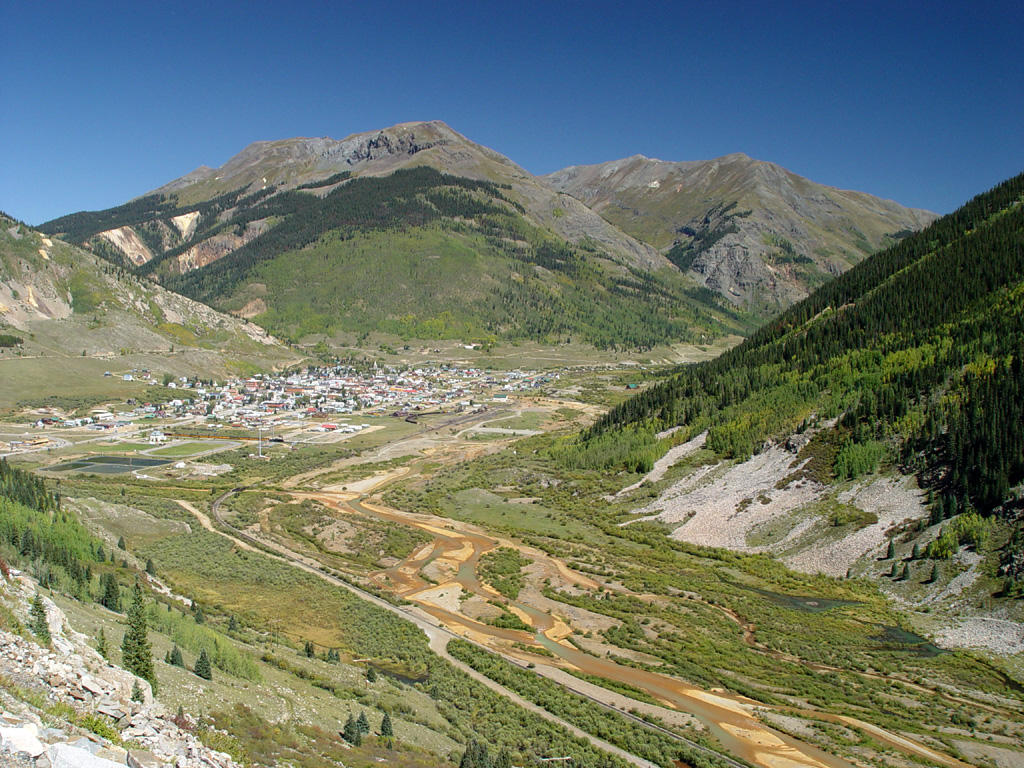
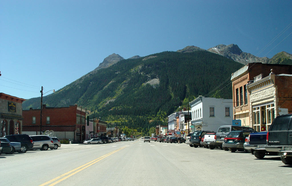
We go up higher now into splendid, pointed mountains with tall, skinny pines and aspen. We take pictures at Coal Bank Pass and before Lime Creek Burn. We cross the Molas Divide and head down out of the mountains into Silverton, a small, pretty Victorian town in a flat valley.
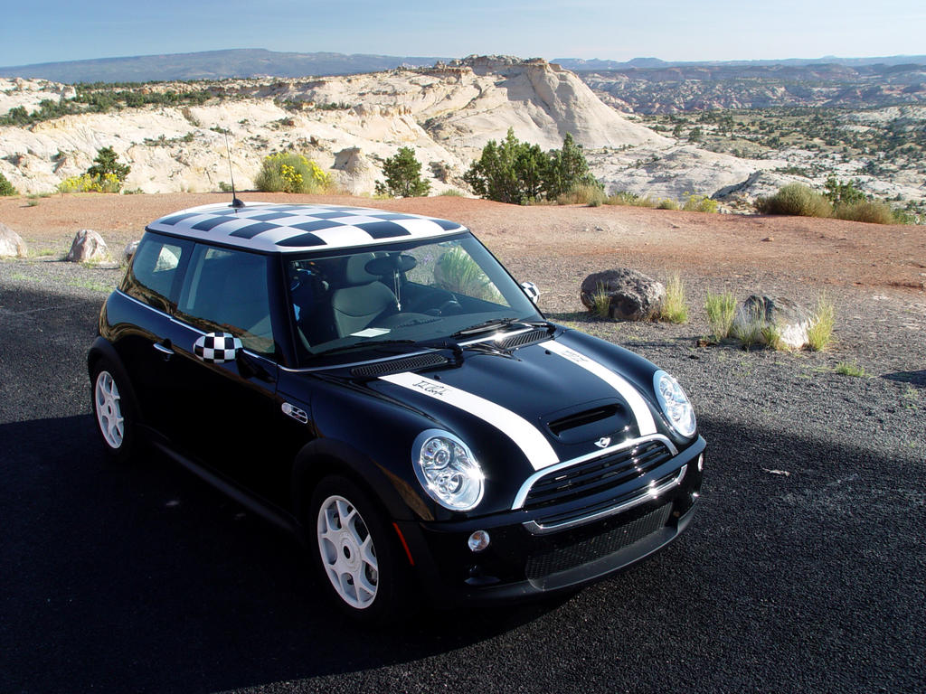
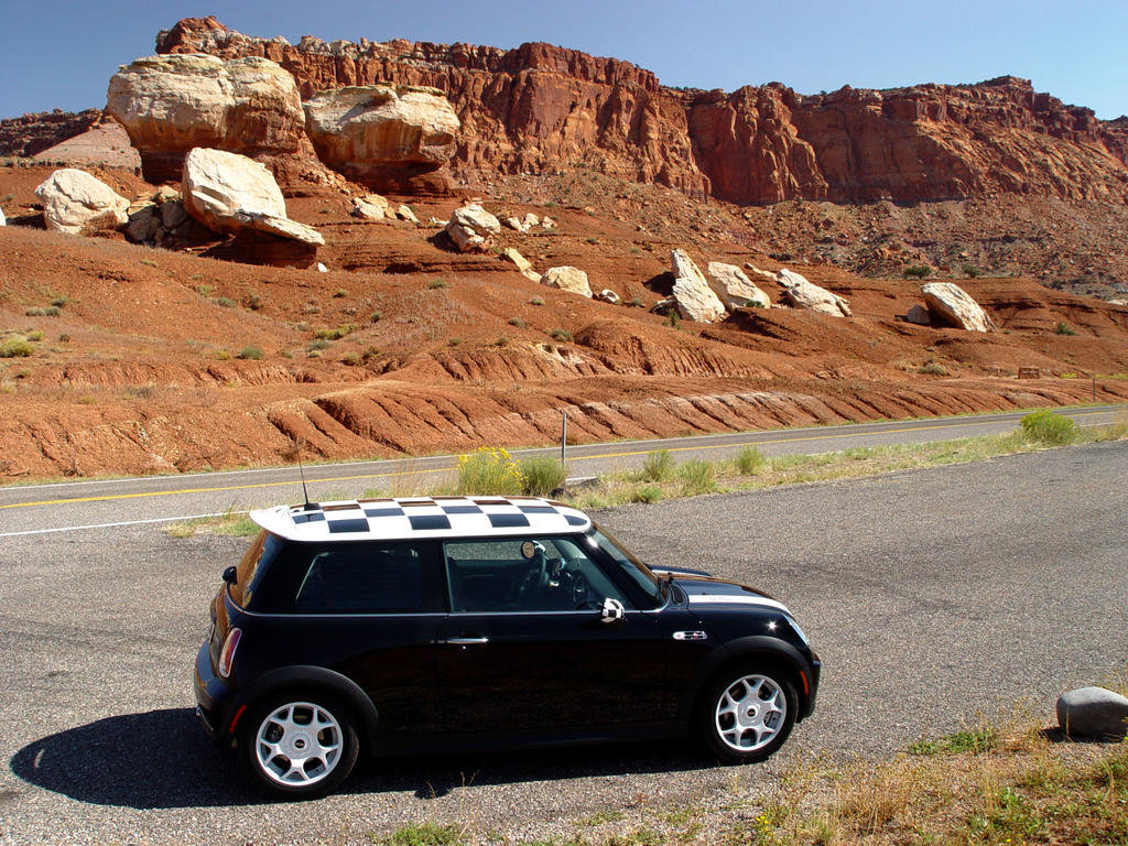
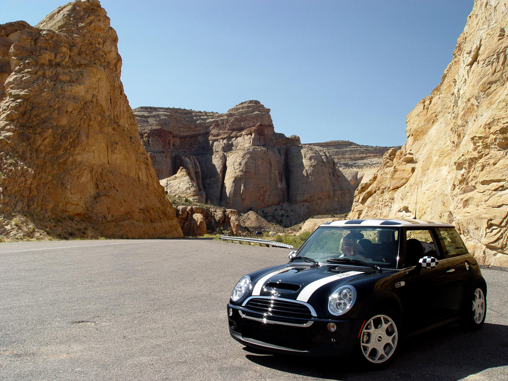
Then we head up through higher mountain valleys again. We have seen hillsides of pine poles laid down flat, probably from avalanches. Between the pines there are open patches of brown, rust and deep yellow gravel on the mountainsides. There are no guardrails on the sides of steep drop-offs. Sneeze once driving a Mini Cooper and you’re done for!
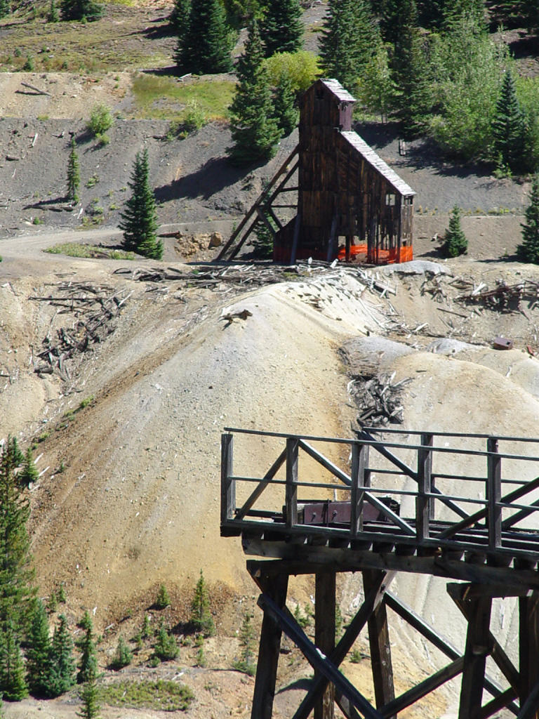
In the Red Mountain area, old wooden mine shafts appear. There is one large one in particular halfway up the mountain, with old mine tailings running down into the river. We see some fall color on the hills, yellow aspens with the
 pine. We stop in the valley to take pictures. There is a high railroad trestle for loading ore, and some white clapboard houses, probably for the workers or mine company officials.
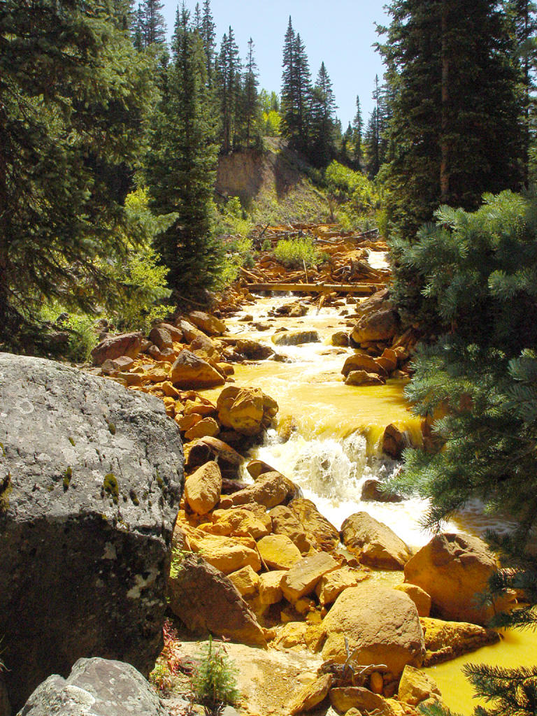
We continue north on 550. A little way past the mines a bright yellow river runs next to the road! The surrounding rocks are also dyed yellow, possibly pollution from the mines? Part of a snowdrift still lies in the riverbed!
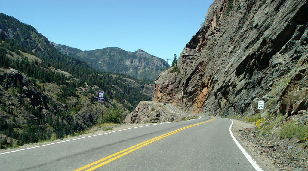
As we drive on, the mountains become solid gray, bare rock with sheer drop-offs and no guardrails. Michigan authorities would be
 appalled! We are about to descend into Ouray (pronounced You Ray), the Switzerland of America.
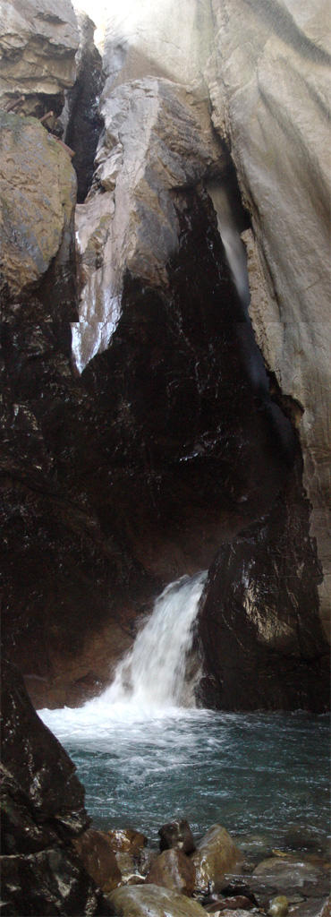
Before we go into the town, we take the turn-off to see Box Canyon, a narrow fissure between high rock cliffs with a spectacular waterfall running through it. This tourist attraction is at least 100 years old, because we actually have pictures of it in our stereograph collection!
You see the falls and river via a metal mesh walkway hung halfway up the fissure wall inside
 the canyon. Because this small canyon is so narrow (only a few feet wide in places) it is mostly dark inside. At the back of the canyon there is a stairway to the river below.
The falls rush down, then turn like a waterslide around a giant rock column, with a final mighty cascade into a circular pool. The crystal clear water runs through the fissure over rocks and around boulders until it leaves the little canyon. It is an absolutely beautiful display. You can take another walk up to the top of the falls where you can look down through the fissure as the water rushes around the rock column slide.
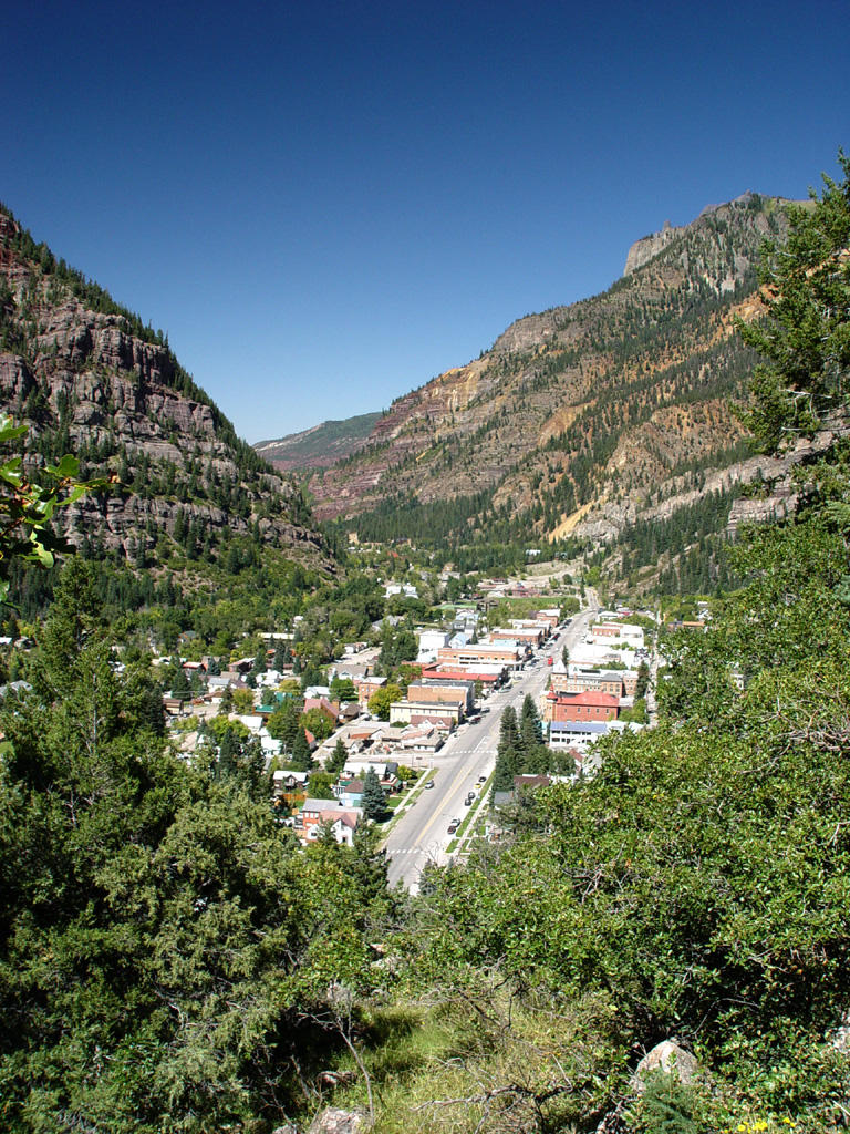
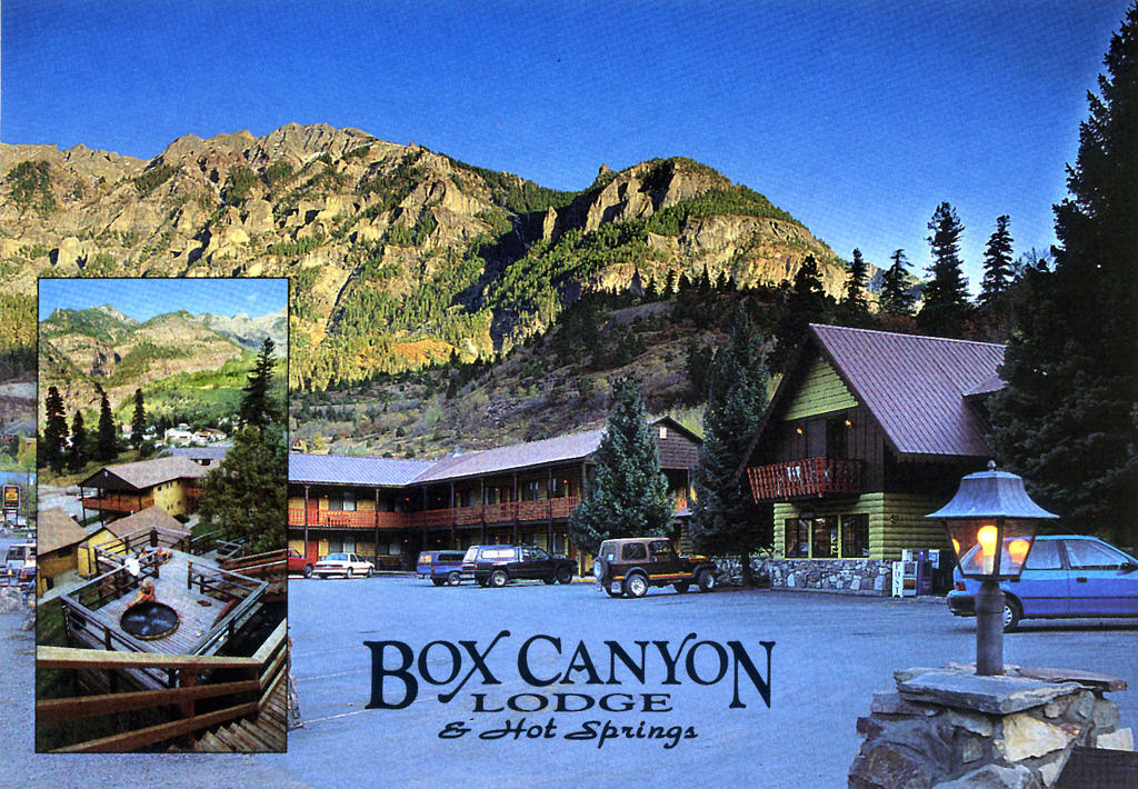
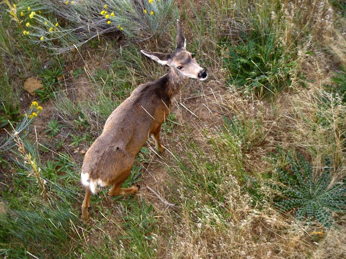
After seeing the falls, we drive into Ouray and stay at the Box Canyon Lodge, complete with hot tubs on the mountainside! While we enjoy the wooden tub on its little deck, a deer walks by on the hill behind us. The motel takes its water from a hot spring running down the hillside, reduces its temperature from 140 degrees, then pipes it into
 the tubs. In fact, Ouray is known for its hot springs. Many of the hotels have hot tubs, and there is a giant, public hot spring pool on the north side of town.
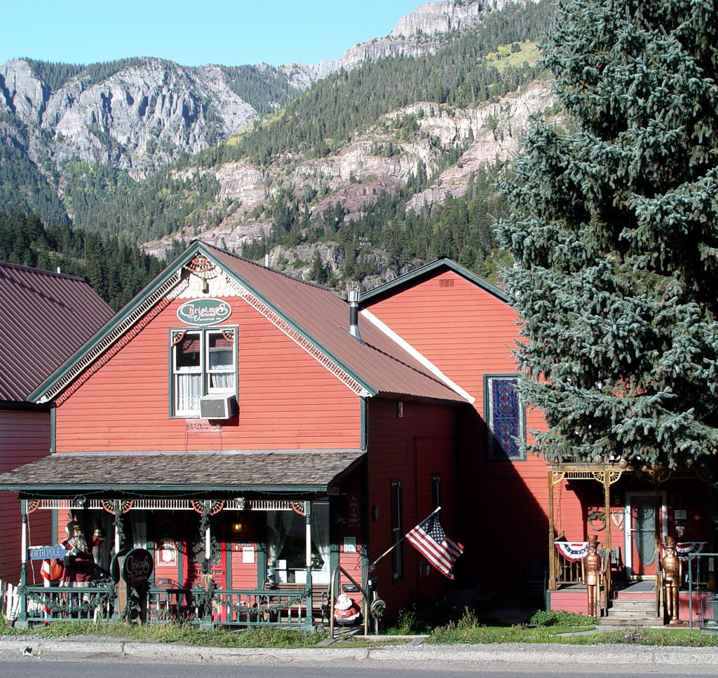
We walk into town for dinner that evening. Ouray is an old Victorian town with beautiful, ornate houses and highly decorated town buildings. We eat dinner at the Bon Ton Restaurant in the basement of the St. Elmo Hotel. The side entrance of the hotel is reached by walking through a patio filled with tables topped with umbrellas, which are surrounded with plants and trees lit up with soft white lights.
We sat for a while in the elegant main parlor of the hotel until our table was ready, and then went downstairs to the beautiful red brick and timber restaurant. The food and drinks were superb. Mark was very impressed with the quality of the martinis!
 We relaxed in the hot tub again after dinner, with another deer and fawn grazing on the side of the hill above us. Ouray is a beautiful place, and we thoroughly enjoyed our stay here!
Tomorrow we will drive down out of the mountains and head northwest into the desert again to Moab and Arches National Park!


Tuesday, October 11, 2005
Storm Clouds Rising----Burnt to a Crisp!
 This is a day of storms and rain—but all the storms are far away, in the distance. They surround us on all horizons as we move through the land, always in the sun.
After taking pictures of the sunrise in Monument Valley, we leave Gouldings and head south on 163 to Arizona. Storm clouds flank us on the east and west. The clouds are white, with points of rain falling from them. Long plateaus of monuments follow us down the western side of the road. Kayenta lies in front of them. The tan mountains are dark with vegetation and cloud cover. Rain falls above them and also to the south
 now.
now.We turn northeast on 160 into a yellow-green plain. Some horses and cows graze to the south. A single, dark gray monument sits before us to the northeast, backed on the north by a very long, low mountain range of light red round-top tipped-up rocks. They are tipped high to the north, low toward us, and go on in a straight line for miles. This might be what they call Comb Ridge on the map, except that this comb is stubby and the teeth are fat!
South of the road, a small red monument range
 comes into view, with chimneys like Bryce facing our way. Several arms stick out, with many defunct tourist buildings sitting in front. This place is called Baby Rock. Several police cars with flashing lights drive toward us. They are escorting a giant dump-truck box from a T-Rex!
The plains are reddish rolling rock now, with very little vegetation. The land burns in the sun. A low, round-edged buff-colored canyon appears, running southwest to northeast under the road. It is Chinle Wash near Tes Nez Iah. People live near scattered trees and brush in the wide, flat wash bottom. Horses graze above on the southwest rim. (What are they eating, rocks?)
The road turns more easterly to Mexican Water. Pointed brown mountains rise up, which we pass through into another plain of yellow-green scrub.
 It slowly becomes more grassy, with a little red monument to the northeast. A small, curious town called Red Mesa sits in front of it near the road. The houses are metal, surrounded by a square metal wall around the entire town.
There are mountains on the south side of the road now. They look dark, back-lit by the sun, with white storm clouds drifting above them.
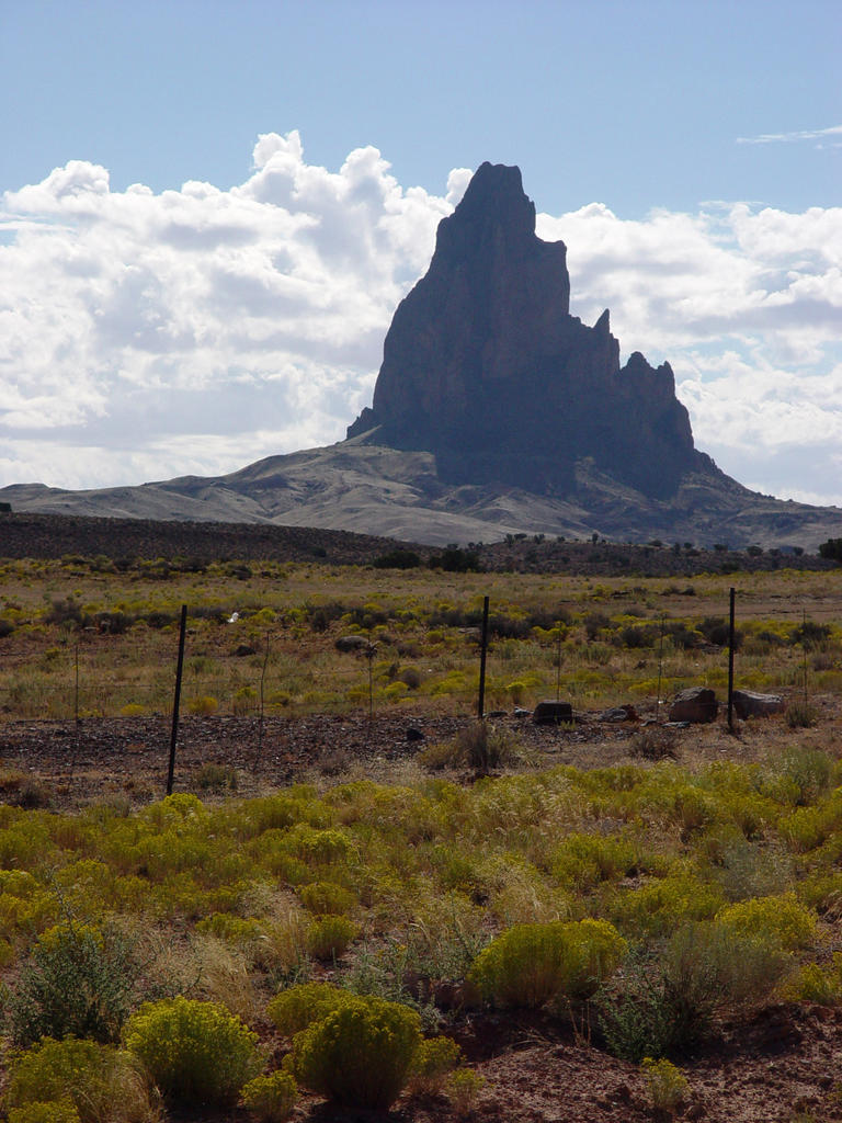
We come to Teec Nos Pos, very close to the New Mexico border. The dark mountains to the south are much bigger now. There are mountains to the north also, with bands of buff, mint green in
 the middle and pale purple on the bottom. The grass is more sparse here, with scattered juniper trees mixed in.
We turn north, seeing dark mountains in the distance, still on 160 to the Four Corners area. In front of us a stake truck is rolling along at 65 mph with two cows milling around in it! Too bad for the cows if anyone suddenly stops!
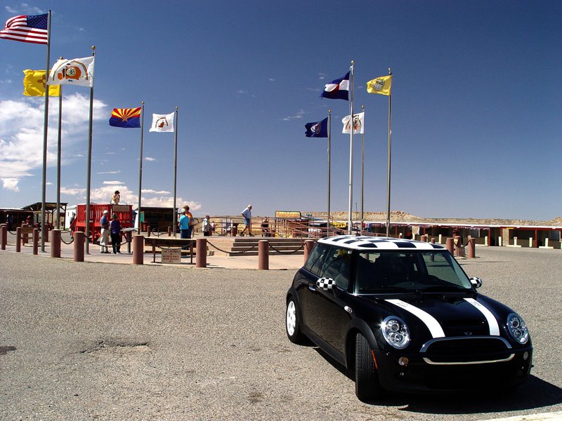
The Four Corners is a bare rock wasteland. Of course. That’s why we gave it to the Indians. The Navajos have made the place into a tourist trap, $3 per person to get in. Hey, they gotta make
 money somehow. What would you do if you were living on a rock?
There is a cement plaza circle with flags flying, marking the area where the four state corners meet. The plaza is surrounded by another circle containing a small tourist office and many wooden booths with Indians selling their wares. Mark told me that each tribe has to be in its own state. Most of the jewelry is quite nice with good prices.
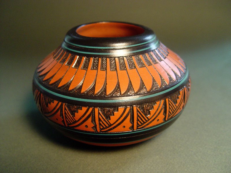
We bought a dark red pot with black designs and turquoise painted bands. The carving is very
 neat with clean, straight lines. I thought it was the best pottery there. It was done by a Navajo artist, Freida Lee. I also bought a sand painting done on a sandstone rock by the artist Alfred Beyaue. It is an Indian on horseback hunting a buffalo, and again the work is very precise with clean lines. We think his sand paintings are the best and most imaginative in the group. He’s kind of a jokester, too. As he was writing the title on the back of the rock, he said to me, “How do you spell Indian? I….N….” I said, “If you don’t know how to spell Indian by now, I’m not going to tell you!” Mark also bought a decorated arrow, which he later hung in his workshop at home.
After the Four Corners, we turn more easterly on 160 into Colorado, passing over the San Juan River, filled with small, lush trees and actual running water! Quite a novelty for this part of the country. Most of the land we have traveled through today has been quite barren. This area is no exception, with many low, rounded sand-colored hills
 covered with short, pale gold grass.
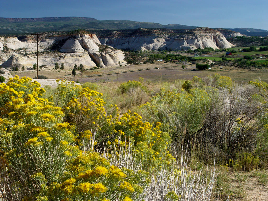
We go north on 160/491, heading to Cortez. A light gray-brown monument lies east, with plateaus behind it. The plateau has a thick rock cap on top with sandy hills eroding down from it. The storms continue around the edges of the brilliant blue day, with much rain to the south of us right now.
As we approach Cortez, the sandy plateau draws near, skirting the eastern edge of the city. The dark mountains we saw in the north at the Four Corners are closer and bigger. Horses graze on large, grassy lots with short trees, and small houses and trailers mark the southern outskirts of the large, spread-out city. In the modern, central part we stop at Radio Shack to get another photo memory card for the camera. We look up to see storm clouds and rain covering the entire eastern horizon.
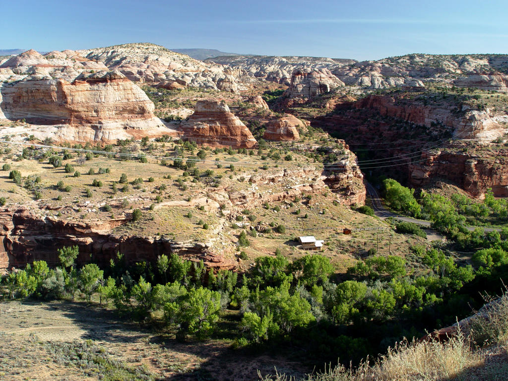
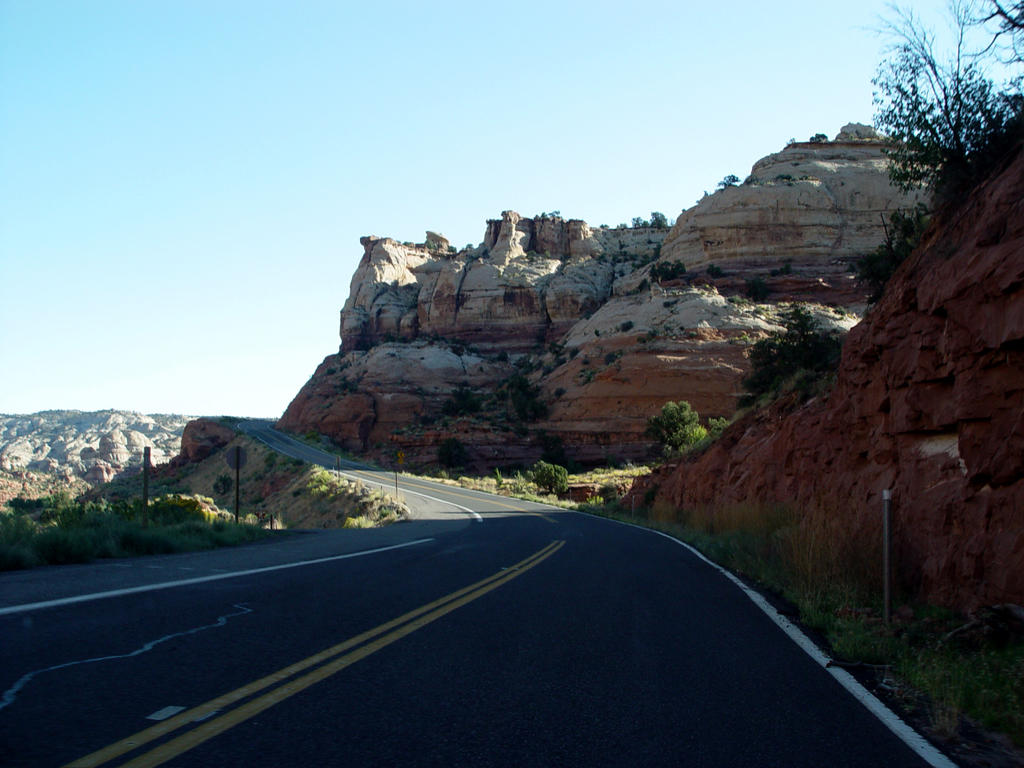
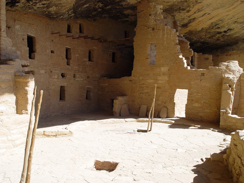 The plateau recedes from the city and ends as we turn east, still on 160, which is now running on the north side of the Mesa Verde Park. The Mesa Verde Mountains mark a change in the territory. They are more pointed, taller and darker than the sandy, rock-covered plateau near Cortez. The ground cover is a medium green with junipers on the southern Mesa Verde Mountains. We turn from 160 onto the park road, which runs south for 20 miles. We decide to explore the park first, before we go to our room at the main lodge.
You have to drive through the WHOLE park before you can see any of the cliff dwellings,
 which are at the very bottom. As we are going along, looking at the scenery, Mark and I both decide that, you know what, there really isn’t much to look at here! This park is merely a series of north-south rounded, low rock ridges covered with scrub and short bushy trees. And all of the trees have been burnt to a crisp! Fires have gone through the park continuously over the years. Actually, if the trees had not burned, you wouldn’t be able to see any of the park at all, because they are very close to the road. We decide that it would be better if nine-tenths of this park were turned into condos!
We go south to the Spruce Tree House, an interesting cliff dwelling that is easy to get to. There is a round subterranean room that you can climb down into via a wooden ladder. We walk
 back up the trail to the museum, also very nice.
We travel north about half way up the park road to the Main Lodge, Visitor Center and Far View Terrace gift shop. While we are buying souvenirs, we turn around and see the most exquisite pottery ever. And the artist, Bob Lansing, was there! He had just finished a demonstration of his carving techniques. He makes the pots, then etches the designs with an Exacto knife. The detail is so fine it looks like an engraving. He does patterns and animals that are just superb! We did buy some other souvenirs—two wine glasses with whimsical petroglyphs on them, and a sweater for me.
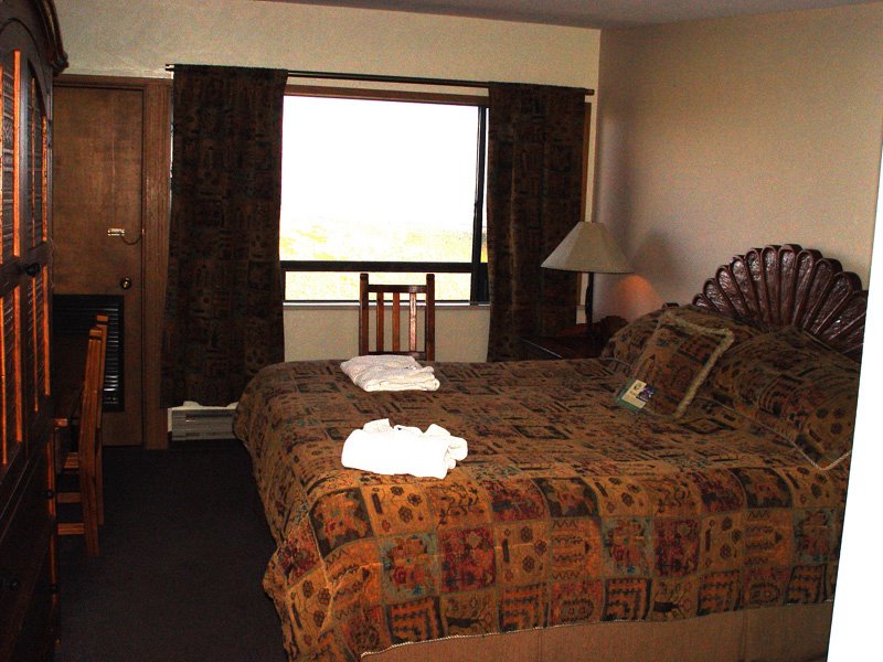
The Far View Lodge is a series of rectangular
 buildings facing south on a hill that overlooks the park. Now, there may have been a view at one time, but half the rooms don’t look at anything any more! Typical of most parks, they let the brush grow up, obstructing the view in many areas. Also, the more northerly buildings simply look into the backs of the south rooms! What a dumb design! The rooms don’t look like much from the outside, but our room at least had very nice western furniture inside, and a balcony with a view. All the rooms are built high up, with balconies on the south side. We went out on our balcony, looked down and saw a deer grazing right below us!
We went to the Main Lodge for a superb gourmet dinner. It’s a beautiful place, with white stucco, dark wood beams and posts and a view south to the park.
The next morning we wake up to a cool, clear day. We see deer again off our balcony. As we drive away from the parking lot, we see four bucks feeding at a large metal tub.
 The park is feeding the deer! That’s why they are hanging around the motel rooms!
We have decided not to see the other ruins. We’re not that interested in them, and the rest of the park is nothing special. I think this park would be a good place to go, just as long as you realize there is NOTHING here except for the ruins and the fine dining at the main lodge.


Saturday, October 01, 2005
America the Beautiful
We leave Bryce Canyon going southeast on Highway 12. The road leads down through the arid canyon lands we saw from Bryce.
We go through Tropic, Cannonville and Henrieville, old towns filled with small houses in large, flat valleys. I have noticed that most old houses in the Southwest are small. The long irrigation lines with their large wheels are spraying brilliantly in the morning light, making the fields green.
The road turns northeast, gathering more vegetation and trees as we approach Escalante. Cows a
 nd horses graze here and there in fields and in the dry wash beds. At Escalante, a half-dozen turkeys cross the road!
Going east, the country turns to canyon lands again after Escalante, colors alternating between white rock canyons and red. We come to a large area of white rounded canyons of deeply scored smooth, bare rock. It’s different from the other areas and quite striking. The variety of rock shapes and colors and quantity or lack of vegetation in this Southwest trip are astonishing. Within a few minutes the landscape can change completely. Or…..it can just go on forever!
 The red Escalante Canyons and Calf Creek area are especially beautiful, a narrow river valley filled with trees and grass with the canyon walls close to the road. There is camping nearby and nature trails which I’m sure would be great to see.
We turn north to Boulder (Utah!), a town sitting on the edge of white-plateaued cliffs. The large, flat valley next to them is filled with grass, trees and little old houses. Neat motels and camp outfitters dot the valley and nearby hills. I get the feeling it’s an organic community. (Probably full of Bush haters!) I really liked the looks of this town.
 After Boulder, the mountains turn to wooded pine. A deer and fawn graze in a small meadow. The road ascends north into green rocky pastures with birch and other trees, creating beautiful, pastoral scenes with vistas of canyons below.
We descend from the Boulder Mountains just south of Grover. Mark is having fun again, racing thru some curves. As we come over a little hill, three giant black cows are standing right next to the road! Boy, that would have been a mess! Grover sits below, in flat, green valleys with red cliffs all around. North of Grover, the vast red plateau cliffs of Capitol Reef run west to east. I
 didn’t understand why it is called a Reef, but looked at from a distance, it looks like you are coming up to a reef or an island, the plateau is so large. The road, Highway 24 now, follows it along on the south side, a spectacular ride.
After a while, the red cliffs turn tan with the road going through them. Then the cliffs turn into a bizarre, gravely gray landscape with no plants, very similar to the Tepee area of the Petrified Forest. This area is called Luna Mesa. I think it is between Caineville and Hanksville. I wish we had stopped at a weird store we raced by, called the Luna Mesa Oasis. It’s a little hippie shack covered
 with kitschy stuff sitting next to the road. I don’t even know if it’s really operating any more, but it looked intriguing!
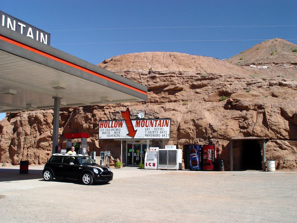
We stopped in Hanksville to get gas at Hollow Mountain, a store built inside a little mountain! Then we went next door to Blondie’s (surprisingly good), the only restaurant for the next 100 miles until Monument Valley. So be forewarned! There are no towns going south from Hanksville on Highway 95.
We drive south, through desert lands on the east and the tall, dark, Henry Mountains on the west.
 There are no trees. The ground cover is dark green, light green, blond, tan and yellow. We are amazed in this trip at how colorful the desert can be.
Near N. Junction 276 we pass through light red-tan rounded top cliffs very close to the road. Little green trees and scrub cover the valley floor. The cliffs turn redder going down to Glen Canyon. Lake Powell is all dried up! It’s pathetic! The boat ramp, which looks like an airport runway, still isn’t long enough to reach the water!
Going southeast from Lake Powell, the cliffs turn a
 blackish red color, but the valley floor is buff colored. This is the White Canyon area, and there are narrow white canyons and other holes in this valley floor. The red cliffs diminish after S. Junction 276, and the ground cover thickens with gray-blue scrub and junipers. The road turns east with the red mountains of Natural Bridges Park on the north side.
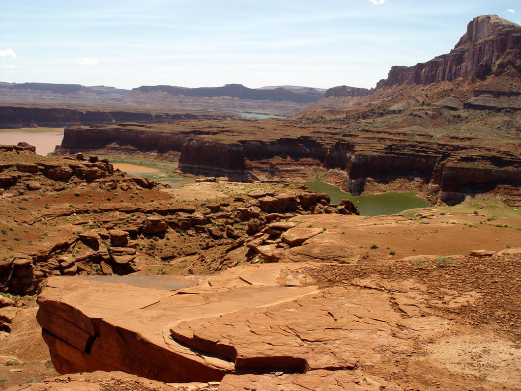
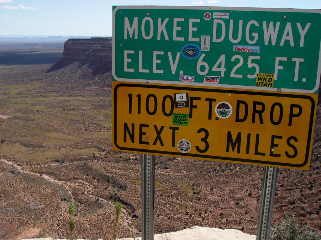
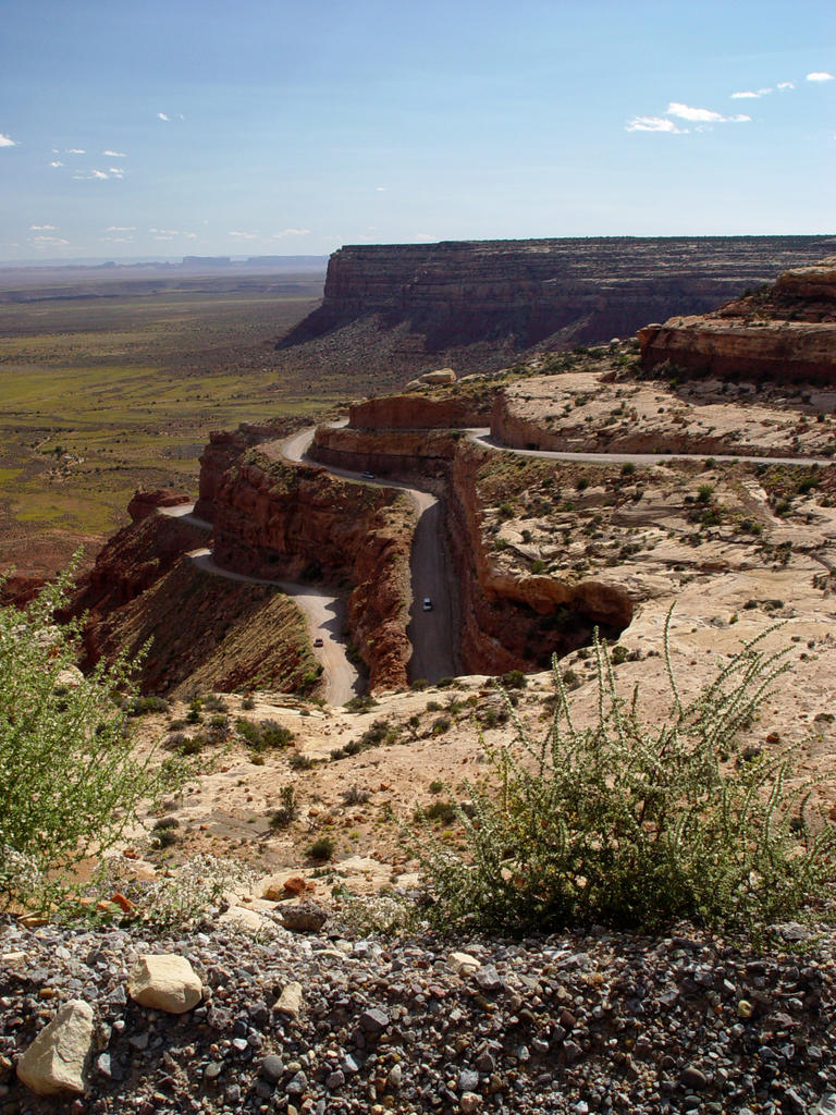
We drive south on 261 towards Mexican Hat. Junipers cover the land, but two to five foot high yellow, bushy flowers line the highway. Now comes the best part! I really wish they wouldn’t print cautions on maps for this area: Warning! Mokee
 Dugway is gravel with 10% grades and switchbacks for 3 miles! They make it sound like you’re going to drop off the edge of the world. Well, guess what? You are!
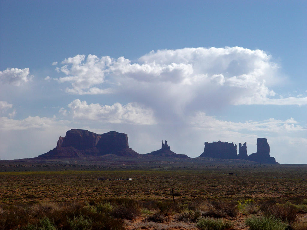
Giant, steep switchbacks drop off from narrow, gravel roads into Monument Valley, an immense, yellow-green plain stretching south all the way to the monuments, 40 miles away. We could actually see them in the distance, and the view is just awe-inspiring! The distance to the horizon is incredible. One minute, you’re driving along in your little world, thinking everything is OK, and then the next minute, that world goes away. It is a stunning view
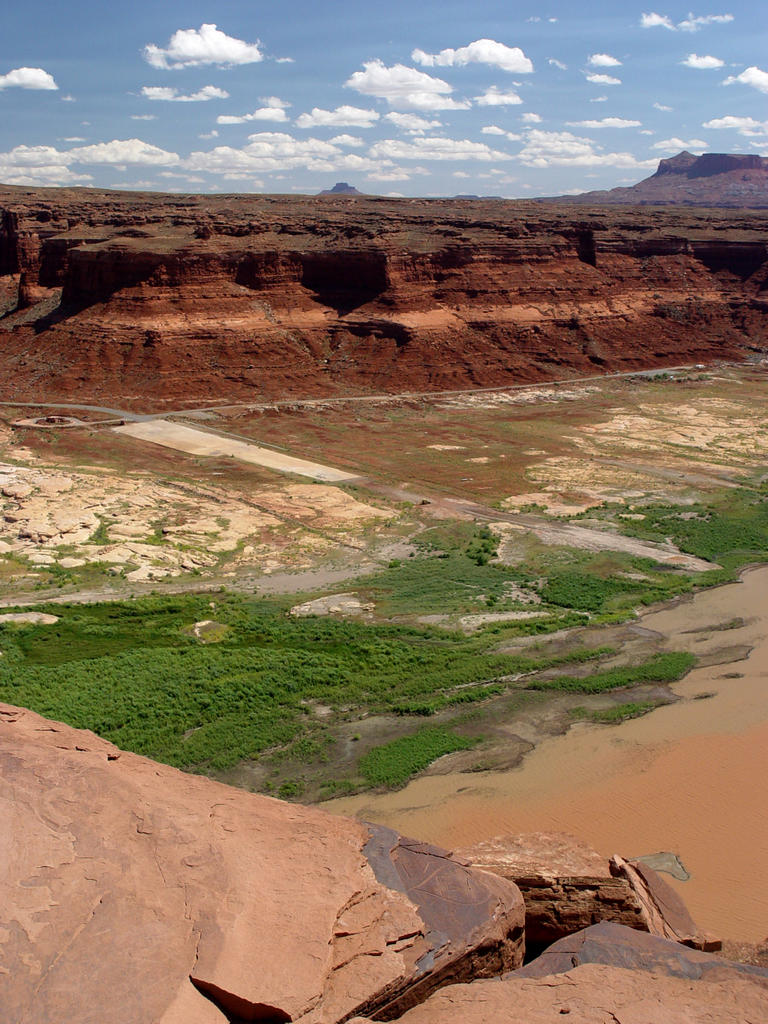 on a clear day.
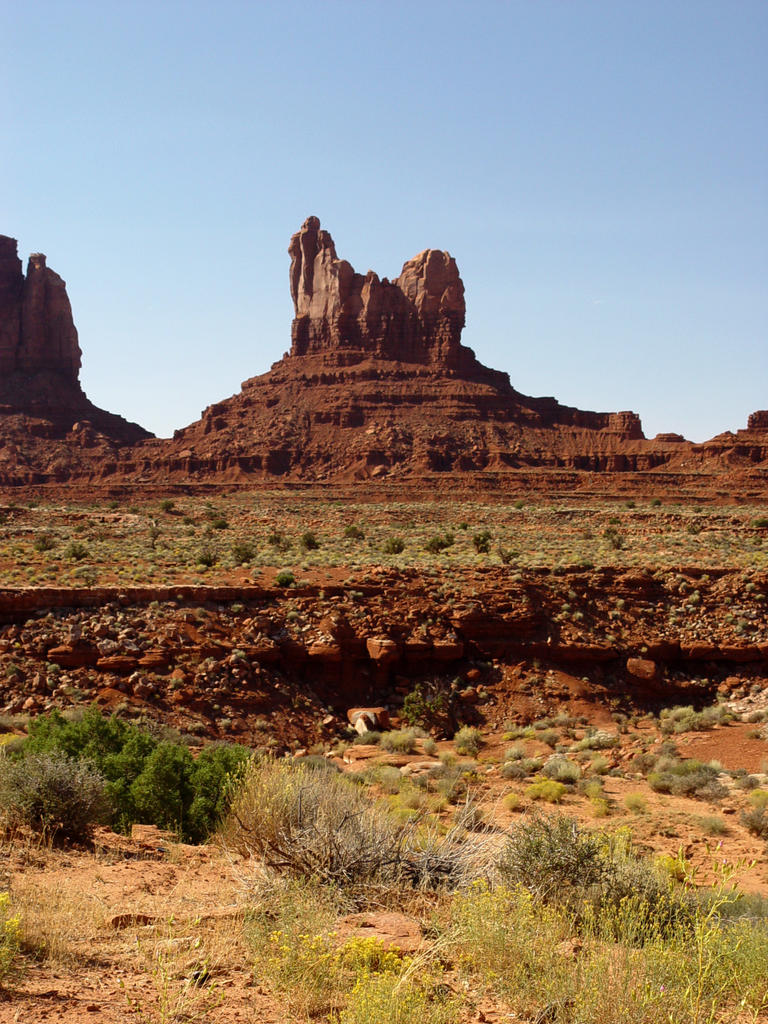
We travel southeast through the plain to Highway 163, then south to Mexican Hat, which gets its name from a little rock pinnacle that looks like a hat. The monuments to the south are dark hazy blue, silhouetted against a white hazy blue afternoon sky. We continue southwest to Gouldings. Cows are in the road as we take the turnoff west to Gouldings, a few miles above the Arizona border.
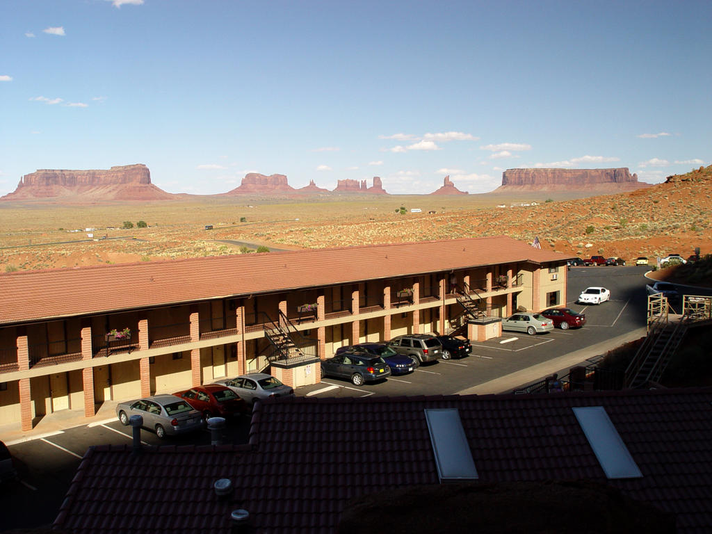
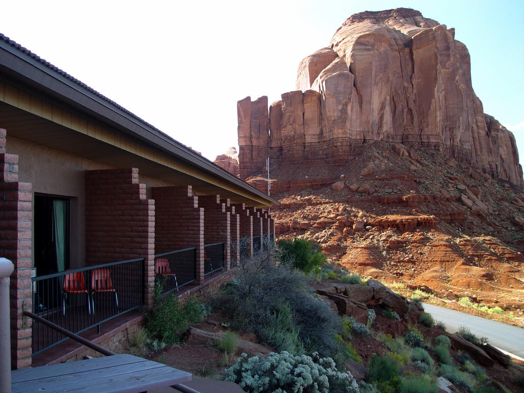
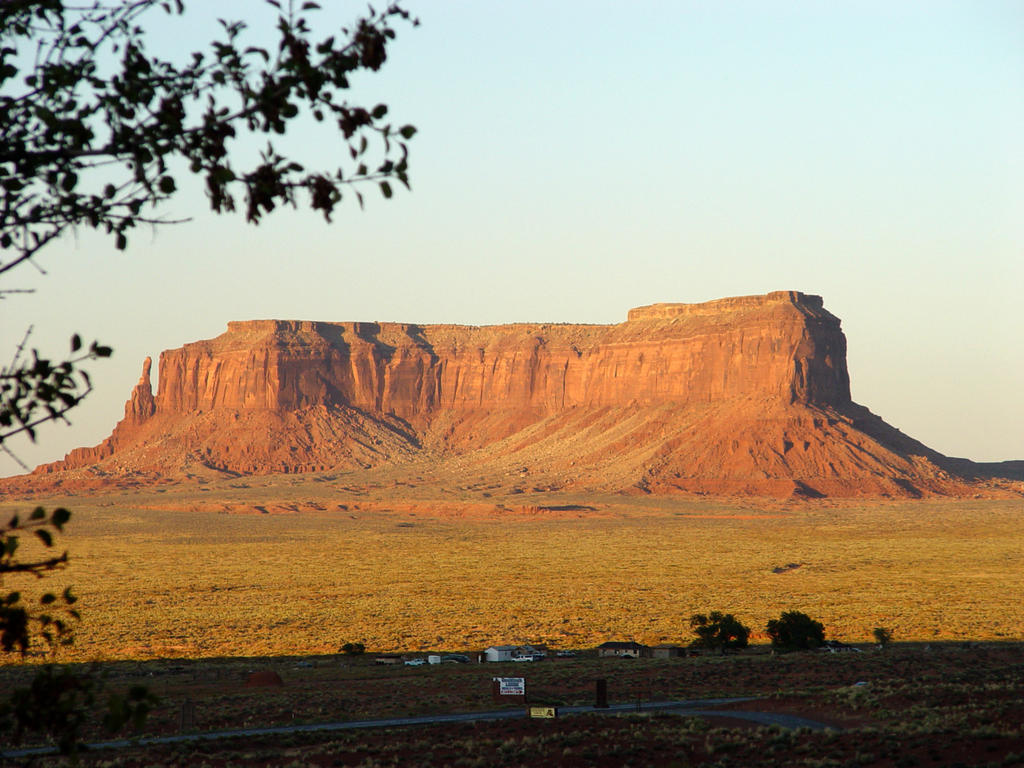
The main motel faces north and sits in front of a giant monument! It’s really cool! The place is really like a small town. There is a gift shop, museum, restaurant, laundry, car wash (Mark was ecstatic!), grocery store, a campground in between two monuments, and a plane out in front of the whole area! The long motel runs east and west, and every room has a balcony and a view. They also have little bus tours to see more of the monuments on the Indian lands.
 Mark and I ate dinner, which was very good, and then sat outside. Our particular room led out onto a large, triangular patio made of red slate that sits atop a little rocky cliff. We are on the second level of the motel. The first building sits below us. As the sun goes down, the monuments get redder, and then headlights can be seen all over the yellow-green valley.
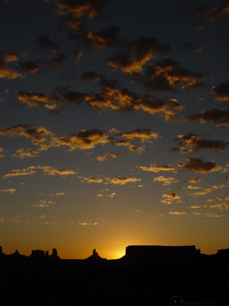
In the morning, Mark gets up early to take pictures of the sunrise coming up over the monuments. There are little fleecy clouds in the east, which add great color and interest to his shots. The monuments to the west turn bright red. Other
 people are standing on their balconies or walking out onto the large patio in front of our room.
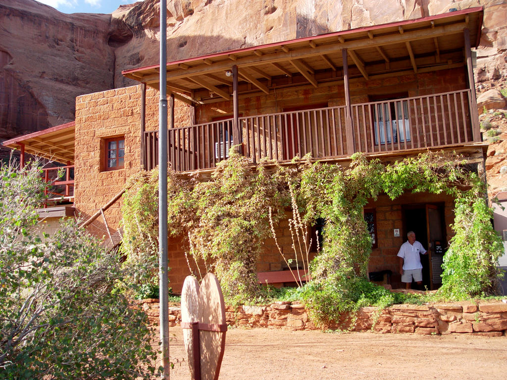
Later, we visited the museum, which is the original Gouldings Trading Post. It is very interesting, with many old pictures of the Gouldings, their Indian neighbors, and also movie stars from the old western movies made in the valley. The Gouldings lived on the 2nd floor of the trading post, and their belongings are still there, a really neat house.
Then it is time to get in the car and head south to Arizona, many other monuments, the Four Corners, and
 Mesa Verde!
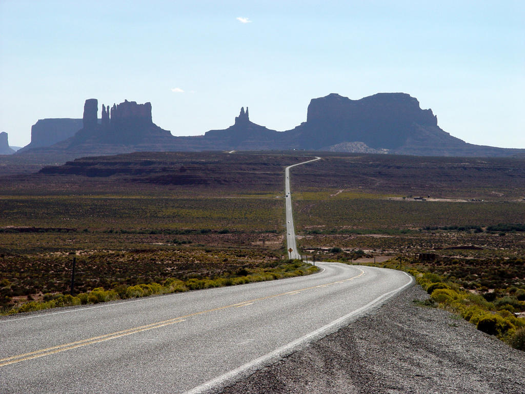


![]()