Tuesday, November 29, 2005
Junkyard Dogs and Hole N' The Rock!
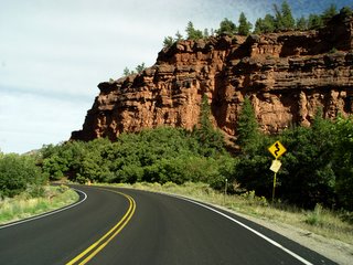 They say that Ouray is open to tourists all year long, but some of the businesses in town do close at the end of summer. In the morning, we decide to visit a bakery we read about in one of the tourist brochures, but when we get there it is closed for the season, on account of the baker going to Africa for the winter! (That’s gotta tell you something about the weather here.) There are bars and restaurants, but it is hard to find anything open for breakfast. We finally go into a spacious, sunlit coffee shop with many blond wood tables and a very long line of people waiting for service. There is a lone worker behind the counter, taking orders and running around like
  mad. Mark is not happy. Mark does not like to wait for anything. If Mark had his way, we would never eat, except maybe once a day, when he could get a martini with his dinner. However, we do wait, because divorces are expensive.
We eventually obtain good coffee and pastries, and then Grumpy and I set off into the unknown on our next leg of the trip. We come out of Ouray’s bowl-like mountain valley and head north on Highway 550 to Ridgway. The mountains get smaller while the valley widens into farms and pastures. At Ridgway we turn west on 62. It is a sunny, clear day as we drive
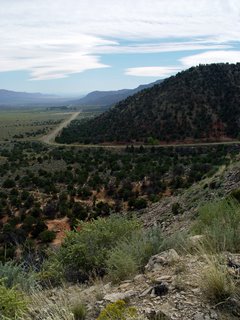 through farm valleys with giant rolls of hay in the fields. A row of high mountains lay behind them to the south.
We go southwest into rounded green mountains, and meadows bordered with aspen forests. The aspens start to mix with pine and blue spruce as the valley becomes narrower and meadows diminish. The mountains show more rock now. It is blocky and chunky looking, white and red.
Placerville sits in a narrow river valley along the south side of 145 going northwest to Norwood. The road runs above the town on the north. Chunky red rock cliffs line both sides of the valley with a pretty stream running through the middle.
High, thin clouds form bands in the sky as the valley widens. The mountains round and change to pinkish tan. The road crosses the river, then rises up sharply to the mountaintop on the southwest side. A grassy pastureland covers the high plateau. Norwood and Redvale are both ratty
 little towns with small houses. Junky farms are scattered about. There are high, pointed mountains to the west with lower, longer mountains to the north and south.
Near Junction 141 just before Naturita, desert plants start to take over! We see junipers, blue-gray shrubs and yellow-flowering bushes again. Naturita is another junky town! Junkyards are all over, with more ratty houses and many rusted cars. I guess people like to keep their own personalized dumps here. You never know when you might need to recycle something!
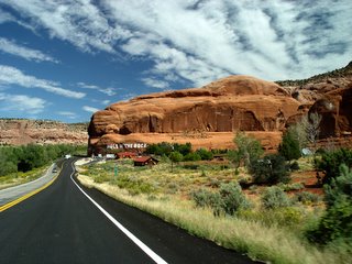 We turn northwest onto 90 at Vancorum and drive through rocky tan mountains that turn down into a wide valley. This valley runs northwest for miles all the way to Paradox. There are long flat mountains dotted with junipers to the south, while the north is dominated by a long, red and white banded rock plateau. The valley starts with desert scrub and junipers and ends with farms. At Paradox, the road twists up over the southern mountains into red and white rocky cliffs, very picturesque.
We pass over into Utah, going west on 46 up into white, chunky pine-covered cliffs. They end in
 grassy plains with farmland and trees stretching north up the sides of a beautiful set of rounded mountains with bare tops. These are the La Sal Mountains, and we circle them as we continue west and then north on 191. We view their pretty green meadows and forests from many angles as we travel along.
On 191, the country changes completely to red rock canyon lands! Then we see something quite amazing. It is Hole N’ The Rock! We know this because there are giant, white letters about 20 feet high painted on the side of a small, red mountain right next to the side of the road. This
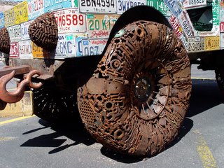
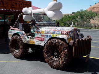 tourist trap has every kitschy thing you can imagine. It also has a house with regular windows and doors built into the rock!
There is a small pool filled with plants and sculptures, many cactus gardens filled with statues and other various objects, a zoo and a trading post. And of course, the Hole N’ The Rock, which started out as a small restaurant. Albert, the guy who made it, just kept blasting out more rock until he turned it into a house.
Albert had many hobbies including painting and sculpture, which he got pretty good at. Then he
 tried his hand at taxidermy. Boy, he should have left that one alone. Poor donkeys! He didn’t kill them; they were the donkeys he used to carry out the rock after blasting. When they died, he decided to stuff them, and they can still be seen inside the house today. This whole place is an unusual, fun area to visit.
We continue north to Moab, a large tourist town surrounded by red rock desert. We check into a hotel, then drive up to Arches National Park. We find out that although there are many interesting rock formations, most of the arches are at the very end of the park and you have to walk about
 five miles round trip to see them! It is afternoon and very hot, so we decide to do this tomorrow morning.

